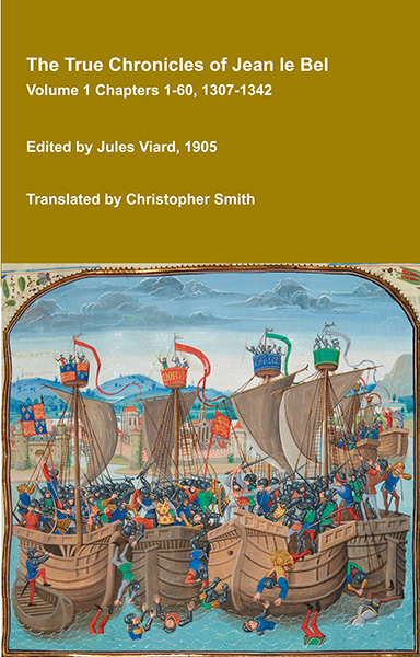
The True Chronicles of Jean le Bel Volume 1 Chapters 1-60 1307-1342
The True Chronicles of Jean le Bel offer one of the most vivid and immediate accounts of 14th-century Europe, written by a knight who lived through the events he describes, and experienced some of them first hand. Covering the early decades of the Hundred Years’ War, this remarkable chronicle follows the campaigns of Edward III of England, the politics of France and the Low Countries, and the shifting alliances that shaped medieval warfare. Unlike later historians, Jean le Bel writes with a strong sense of eyewitness authenticity, drawing on personal experience and the testimony of fellow soldiers. His narrative captures not only battles and sieges, but also the realities of military life, diplomacy, and the ideals of chivalry that governed noble society. A key source for Jean Froissart, Le Bel’s chronicle stands on its own as a compelling and insightful work, at once historical record and literary achievement. This translation builds on the 1905 edition published in French by Jules Viard, adding extensive translations from other sources Rymer's Fœdera, the Chronicles of Adam Murimuth, William Nangis, Walter of Guisborough, a Bourgeois of Valenciennes, Geoffrey le Baker of Swinbroke and Richard Lescot to enrich the original text and Viard's notes.
Available at Amazon in eBook and Paperback format.
Dolesfield Hundred, Wiltshire is in Wiltshire.
The River Till rises at Tilshead Wiltshire [Map] from where it flows through Orcheston, Wiltshire [Map], Elston, Wiltshire [Map], Shrewton, Wiltshire [Map], Winterbourne Stoke, Wiltshire [Map], Berwick St James, Wiltshire [Map], where its name appears to become the River Wylye, then Stapleford, Wiltshire [Map] after which it joins the River Wylye at Sherrington, Wiltshire [Map].
The River Till rises at Tilshead Wiltshire [Map] from where it flows through Orcheston, Wiltshire [Map], Elston, Wiltshire [Map], Shrewton, Wiltshire [Map], Winterbourne Stoke, Wiltshire [Map], Berwick St James, Wiltshire [Map], where its name appears to become the River Wylye, then Stapleford, Wiltshire [Map] after which it joins the River Wylye at Sherrington, Wiltshire [Map].
St Nicholas' Church, Little Langford is also in Churches in Wiltshire.
St Nicholas' Church, Little Langford [Map]. Fine tympanum from the Herefordshire School of Carving.
The River Till rises at Tilshead Wiltshire [Map] from where it flows through Orcheston, Wiltshire [Map], Elston, Wiltshire [Map], Shrewton, Wiltshire [Map], Winterbourne Stoke, Wiltshire [Map], Berwick St James, Wiltshire [Map], where its name appears to become the River Wylye, then Stapleford, Wiltshire [Map] after which it joins the River Wylye at Sherrington, Wiltshire [Map].
Carbon Date. 2100BC. Early Bronze Age Carbon Dates
Report: Antler, SNDRFRC4, id as red deer, from Pit 1, Shrewton, Wiltshire [Map], England. Subm SRS 1982. Comment (subm): The grave goods could not be earlier than 4K BP. This result is earlier than any other from the barrow cemetery and contemporary with dates from the Stonehenge ditch, cursus and the destruction of the lesser cursus. The ditch fill contained small sherds of AOC Beaker, and antler fragments occurred throughout the central grave fill; I believe the AOC sherds and antler are residual and that earlier material was incorporated into the grave fill, to which the 14C date refers.
ID: 8752, C14 ID: HAR-4830 Date BP: 4100 +/- 100, Start Date BP: 4000, End BP: 4200
OS Letter: SU, OS East: 88, OS North: 448
Archaeologist Name: S Rollo-Smith, Trust for Wessex Archaeol
Reference Name: Radiocarbon, 34, 1992, 48; Proc Prehist Soc, 50, 1984, 255-318
Council for British Archaeology (2012) Archaeological Site Index to Radiocarbon Dates from Great Britain and Ireland [data-set]. York: Archaeology Data Service [distributor] https://doi.org/10.5284/1017767
On 14th April 1876 Cecil Herbert Edward Chubb 1st Baronet was born to Alfred Chubb at Shrewton, Wiltshire [Map]. He attended Christ's College, Cambridge University [Map] where he was awarded a double first in Science and Law, leaving with Master of Arts and Bachelor of Law degrees. He married 1902 Mary Bella Alice Finch Lady Chubb and had issue.
The River Till rises at Tilshead Wiltshire [Map] from where it flows through Orcheston, Wiltshire [Map], Elston, Wiltshire [Map], Shrewton, Wiltshire [Map], Winterbourne Stoke, Wiltshire [Map], Berwick St James, Wiltshire [Map], where its name appears to become the River Wylye, then Stapleford, Wiltshire [Map] after which it joins the River Wylye at Sherrington, Wiltshire [Map].
The River Wylye rises on the White Sheet Downs, Wiltshire [Map] from where it flows past Kingston Deverill, Wiltshire [Map], Monkton Deverill, Wiltshire [Map], Brixton Deverill, Wiltshire [Map], Hill Deverill, Wiltshire [Map], Longbridge Deverill, Wiltshire [Map], one kilometre south of Warminster, Wiltshire [Map], Bishopstrow, Wiltshire [Map], Norton Bavant, Wiltshire [Map], Heytesbury, Wiltshire [Map], Upton Lovell, Wiltshire [Map], Boyton, Wiltshire [Map], Sherrington, Wiltshire [Map], Codford St Mary, Wiltshire [Map], Fisherton de la Mere, Wiltshire [Map], Wylye, Wiltshire [Map], Steeple Langford, Wiltshire [Map] after which it is joined by the River Till at Sherrington, Wiltshire [Map].
Thereafter it flows around Great Wishford, Wiltshire [Map], South Newton, Wiltshire [Map] to Wilton, Wiltshire [Map] where it joins the River Nadder.
Yarnbury Castle is also in Iron Age Hill Forts Wiltshire, Castles in Wiltshire.
Yarnbury Castle [Map] is a multiphase, multivallate Iron Age hillfort that covers an area of 11.5 hectares.
On 4th October 1301 Thomas Monthermer 2nd Baron Monthermer was born to Ralph Monthermer 1st Earl of Gloucester and Hertford [aged 31] and Joan of Acre Countess Gloucester and Hertford [aged 29] at Ham Stoke, Wiltshire. He a grandson of King Edward I of England. He married before 1340 Margaret Brewes Baroness Monthermer, daughter of Peter Brewes Count Flanders, and had issue.
The River Till rises at Tilshead Wiltshire [Map] from where it flows through Orcheston, Wiltshire [Map], Elston, Wiltshire [Map], Shrewton, Wiltshire [Map], Winterbourne Stoke, Wiltshire [Map], Berwick St James, Wiltshire [Map], where its name appears to become the River Wylye, then Stapleford, Wiltshire [Map] after which it joins the River Wylye at Sherrington, Wiltshire [Map].
Barrow Plantation Long Barrow is also in South England Neolithic Burials.
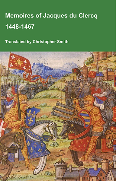
This is a translation of the 'Memoires of Jacques du Clercq', published in 1823 in two volumes, edited by Frederic, Baron de Reissenberg. In his introduction Reissenberg writes: 'Jacques du Clercq tells us that he was born in 1424, and that he was a licentiate in law and a counsellor to Philip the Good, Duke of Burgundy, in the castellany of Douai, Lille, and Orchies. It appears that he established his residence at Arras. In 1446, he married the daughter of Baldwin de la Lacherie, a gentleman who lived in Lille. We read in the fifth book of his Memoirs that his father, also named Jacques du Clercq, had married a lady of the Le Camelin family, from Compiègne. His ancestors, always attached to the counts of Flanders, had constantly served them, whether in their councils or in their armies.' The Memoires cover a period of nineteen years beginning in in 1448, ending in in 1467. It appears that the author had intended to extend the Memoirs beyond that date; no doubt illness or death prevented him from carrying out this plan. As Reissenberg writes the 'merit of this work lies in the simplicity of its narrative, in its tone of good faith, and in a certain air of frankness which naturally wins the reader’s confidence.' Du Clercq ranges from events of national and international importance, including events of the Wars of the Roses in England, to simple, everyday local events such as marriages, robberies, murders, trials and deaths, including that of his own father in Book 5; one of his last entries.
Available at Amazon in eBook and Paperback format.
Wiltshire Archaeological Magazine 1913 V38 Pages 379-414. Tilshead. 7. [Barrow Plantation Long Barrow [Map]] In Barrow Plantation, E. of the village of Tilshead. Length 210ft. (Thurnam). S.E. and N.W. Opened by Thurnam in 1863, who states it was then covered with trees of about twenty years' growth. "Excavating near the east end, a stratum of black earth was found at the depth of about 5ft.; and in and below this a pile of human bones closely packed within a space of less than 4ft.in diameter, and about 18in. in depth. They proved to be the remains of eight skeletons, strangely cemented together, so closely as to show that if not interred after the decay or removal of the flesh, the bodies must have been packed together as closely as possible in the sitting or crouching posture. The lowest skeleton, covered by the others, and most centrally placed, was that of a woman.... The skeletons were those of three men, three women, and two infants, from one to two years of age;... nearly all (the skulls) had been extremely cleft, apparently during life.... The only skull without greater or less trace of violence is that referred to as the deepest and most centrally placed." Mem. Anthrop. Soc. I. 146.
This barrow, referred to by Thurnam as " Tilshead East," and described by Hoare as a "fine Long barrow on a hill," is now quite obscured in a plantation and covered with thick undergrowth and trees; rabbits are also playing havoc with the mound; the ditches are still distinguishable. There is said to be an artificial fox's earth with drain pipes under the mound. O.M. 46 SE.; A. W. I. 93; Arch. xlii. 180; Mem. Anthrop. Soc. I. 146; MS. Cat. 179—184.
Kill Long Barrow is also in South England Neolithic Burials.
Wiltshire Archaeological Magazine 1868 V11 Pages 40-49. In addition to the two or three Oval Barrows opened by Sir Richard Hoare1, I have examined two or three others. The result appears to be, that, like the bowl and bell shaped tumuli, they cover interments sometimes by simple inhumation, but more generally after cremation. Like the circular barrows, they belong chiefly, if not altogether, to the age of bronze, and of burning the dead; by which phrase I understand a period when this metal and this mode of burial were in common but not universal use; implements and weapons of stone being still employed for many purposes, and burial by simple inhumation being still often resorted to. The attribution of the oval barrow to the bronze period might thus be not ill-founded, even if objects of bronze had not as yet been discovered in them. But in a barrow of this description on Roundway Down, near Devizes, in the examination of which by Mr. W. Cunnington, F.G.S., I had the opportunity of assisting, two blades of bronze were found, one with a deposit of burnt bones at the east, another with a similar deposit at the west end of the burial mound.2 In another oval tumulus, moreover, that called "Kill-barrow [Map]" near Tilshead, opened in 1865, I found many of the burnt bones strongly tinged with copper, clearly proving that objects of bronze had been burnt with the bodies.
Note 1. Those referred to in "Ancient "Wilts," vol. i., p. 169 (118), p. 241 (10), p. 242 (22), appear to be of this description. On the last Sir Richard Hoare observes: — "These diminutive long barrows differ very materially from those of the larger sort, in which we have almost invariably found the interments (of entire skeletons) deposited at the east and broadest end."
Note 2. Wilts Arch. Mag, vol. vi., p. 162. Barrow No. 6, Cran. Brit. pi. xxxi., 43, p. (2).
Wiltshire Archaeological Magazine 1913 V38 Pages 379-414. Tilshead. 1. "Kill Barrow [Map]," on the Tilshead — Chitterne All Saints parish boundary. Length 170ft. (Thurnam); S.E. and N.W. Opened by Thurnam in 1865.1 At one time Thurnam believed this not to be a true "Long" barrow, but an oval one of the Bronze Age; but he subsequently changed his opinion and compared its unusual features with those of the Long Barrow, Winterbourne Stoke 53 (Hoare's No. 3). " Both... yielded deposits of burnt bones covered and intermixed with a substance resembling mortar, many of the bones being tinged of a green colour. At Kill Barrow it was clear that several bodies had been burnt very imperfectly, some of the bones being merely charred. Others were stained a brilliant green and blue, but chemical tests yielded no traces of copper. Under a pile of a white friable substance like half-dried shelly mortar, were curious masses of a sort of ossiferous breccia; the burnt human bones, black, white, blue, and green, being closely cemented by calcareous matter. I am now convinced that both are Long barrows, and not Oval ones, as I had supposed." The MS. Cat. gives some details that may not be published elsewhere: — " The primary interment consisted of piles of burnt bones on the floor of the barrow at the east end. One of these to the east of the other, would have about filled a peck; the other, 6ft. or 7ft. nearer the middle of the barrow, was in much greater quantity. These burnt bones were some of them curiously [mixed] with burnt flints, sarsen chips, &c, into what I have called an ossiferous breccia, and many were stained of a beautifully vivid blue and green colour. These burnt bones were unequally burnt, and many merely charred were quite black. Above the bones the chalk rubble of the barrow was curiously changed into a delicate friable cream-coloured substance like burnt shells. I fancy this an imperfect lime, formed probably from the burnt bones having been deposited whilst hot. This substance was very abundant, and would probably have filled a bushel." Two secondary burials of skeletons were found also. One was "one foot deep, — stretched at length, with head to the north (or N".N".W.) " The other skeleton was "in the same position, nearer the eastern end." It seems that the barrow was opened on two separate occasions. The skull from the first-mentioned secondary burial only, seems to have been sent to Cambridge.
The barrow is unploughed and in good condition, but no distinguishable ditch. O.M. 46 SW.; AAV. I. 89; Arch, xliii. 297, note; Proc. Soc. Ant., 2 S., II. 427; W.A.M. xi. 42; xiv. 259 (name); MS. Cat. 258.
Note 1. This barrow is not included among the list of those opened by Thurnam.
Tilshead Old Ditch Long Barrow is also in South England Neolithic Burials.
Wiltshire Archaeological Magazine 1872 V13 Pages 339-342. The Long Barrows differ in toto from those of the circular form, and belong to a different and earlier epoch. From their usually great size, with one end only devoted to interment, they may be quite as much or even more properly regarded as monuments than as mere tombs. They very commonly measure from 200 to 250 feet in length, and in rare cases even 300 or 400 feet. They seldom exceed ten feet in height, and are wider and higher at one end than at the other — usually that pointing to the east; though at times, they range north and south, in which case the south end is of larger size. It is at this larger end, under what we may term the apex of the tumulus, that the interments are found, on or but little below the natural level of the ground. At each side of the barrow is a trench, whence great part of the material of which the barrow consists has been derived; which trenches, it is remarkable, are not continued round the ends of the barrow. From the great size of the Long Barrows, and the often uncertain position of the apex, their exploration is attended with great labour and difficulty, and hence only a comparatively small number have been explored. About fifteen of those in South Wiltshire were excavated by the elder Cunnington and Sir Richard Hoare, and more recently rather more than that number by Dr. Thurnam. From these data a tolerably complete view of the character of these barrows has been obtained.1 Usually — in at least six cases out of seven — the interments consist of unburnt bodies. Sometimes, there is a single skeleton doubled up; but more commonly a pile of many skeletons, as many perhaps as ten or twenty in number, the bones mixed promiscuously, as if removed from some prior place of burial. The greater part of the skulls are cleft, and many of the long bones split, as if the majority of those interred had been immolated, in honour perhaps of a deceased chieftain, and as if not alone human sacrifice, but cannibalism likewise, had been resorted to. In rare cases (and the Long Barrow round which they were now gathered was one), the body or bodies had been burnt, but the cremation was of a peculiar and imperfect sort, the bones being charred, rather than completely burnt like those in the Round Barrows. In one instance, that of the largest Long Barrow in South Wilts, that of Tilshead Old Ditch [Map], which measures 380ft. in length, and was imperfectly explored in 1802, Dr. Thurnam in 1865, found the true primary interment, at a depth of ten feet, consisting of one imperfectly burnt body, and immediately adjacent a doubled-up unburnt skeleton, that of a woman of small stature, the skull bearing indisputable marks of having been violently cleft before burial, and doubtless during life. The burnt body must be regarded as that of the chief, the unburnt one as that of the wife or female slave, slaughtered that she might accompany her lord to the land of spirits.
Note 1. Archæologia. Vol. XLII., p. 169.
Wiltshire Archaeological Magazine 1913 V38 Pages 379-414. Tilshead. 2. "Old Ditch" Barrow [Map]. Length 377ft. (Hoare); 380ft. (Thurnam); NE. and S.W. Opened, 1802, by Wm. Cunnington, who made a section 85ft. long from the E. end, but failed to find the primary burial; he noticed the usual stratum of black sooty soil, and found two secondary burnt burials near the surface of the mound. He then cut a section at the VV. end and found three skeletons lying on a pavement of flints about 18in. above the floor of the barrow. In 1865 it was re-opened by Thurnam who made a large excavation near the E. end; and only a few feet beyond where Cunnington had left off in 1802, he found the primary interment. The following account of the discovery is from the MS. Cat. " No. 235. Ancient British. From the great Long Barrow at Tilshead, near Old Ditch, excavated by Thurnam, September 29th, 1865. This (the primary interment) was found by us after great labour, and at a depth of ten feet under the highest point of the tumulus close to its eastern end. Here, at or below the base, was a pile of large flints mixed with a stratum of black earth, and below these was a small skeleton well preserved, in the contracted position and with head to the north. The skull was smashed, as I thought at first by the weight of the flints, but from the peculiar character of a contused cleft near the coronal border of the left parietal, it would appear to have been purposely cleaved before interment. Within a foot or two of the skeleton to the east, under the pile of flints, and on a sort of pavement of the same, were a heap of imperfectly burnt bones, in larger pieces than is usual in round barrows. This very exceptional deposit after cremation must have been made contemporaneously with that of the body to which the entire skeleton belonged. The burnt bones, which were unmixed with charcoal, were perhaps buried whilst still hot, many of the flints around them being of a red or blue colour and very brittle as if from the effect of heat. The only relic with them was a rude and heavy opalescent flint; whether the apparently chipped edges were intentionally given to it may be doubtful; it is 2½in. long, 1¾in. wide, and thick. Other extensive excavations were made in the most likely situations without finding anything except in one place the bones of a fox a few feet deep."
This barrow, one of the finest and longest in the county, is in excellent condition. It lies on gently sloping ground, not at the top of a hill, and in spite of its great size is not at all conspicuous. It has lately been planted with a row of trees along its crest. As its name implies it is close to the remarkable bank and ditch known as "Old Ditch" that traverses the down for some miles to E. and W. of the barrow; as noticed by Hoare "Old Ditch" makes a decided curve when it reaches the mound in order to avoid it.
The ditch of the barrow is very well defined on the north side, but not so well on the south, for "Old Ditch" passing the barrow on that side has somewhat obscured it. O.M. 54 NW.; A. W I. 90; Arch, xlii., 175, 180, 191, 192; W.A.M., xiii., 231 [Note. The Page here is incorrect; the page is 341]; Bull, de la Soc. d'Anthrop., 2 S., ii., 357, 676, fig.; Mem. Anthrop. Soc, iii., 65, PI. i.,fig. i.; MS. Cat. 235.
White Long Barrow is also in South England Neolithic Burials.
3750BC. White Long Barrow [Map] is 77.5 m long and approximately 47 m wide including the surrounding ditch. Dating of materials found in and around it suggests that it dates from around 3750BC±250.
Wiltshire Archaeological Magazine 1913 V38 Pages 379-414. Tilshead. 4. "White Barrow [Map]." Length 255ft. (Hoare); E. and W. Opened by Hoare and Cunnington but without success, only a few pieces of stag's horns and the usual "line of black earth " being found. This barrow, with 2¾ acres of land adjoining, is now the property of the National Trust. Hoare speaks of it as having been "lately covered with a plantation," but this has long since disappeared, and the whole barrow was for some time under cultivation. In spite of this it may happily still be described as in good condition with well-defined ditches; it is now down to grass, and under its present ownership will not be ploughed again. O.M. 53 NE.; A.W. I. 91; Arch. xlii. 180.
The Port Way, Margary's RM4, starts in London and travels through Silchester Roman Fort [Map] aka Calleva Atrebatum, Andover, Hampshire [Map], Winterbourne Gunner, Wiltshire [Map], Old Sarum [Map], Badbury Rings [Map], Dorchester, Dorset [Map], Poole Harbour, Dorset [Map] to Exeter, Devon [Map].
Time Team Series 2 Episode 5: The Saxon Graves was filmed between 24th June 1994 and 26th June 1994. It was originally shown on 5th February 1995.
Location: Winterbourne Gunner, Wiltshire [Map]
Category: Time Team Prehistory, Time Team Early Medieval.
The Time Team:
Tony Robinson [aged 48], Presenter
Mick Aston [aged 48], Bristol University Landscape Archaeologist
Carenza Lewis [aged 31], Royal Commission on Historic Monuments
Phil Harding [aged 45], Wessex Archaeological Trust Field Archaeologist
Robin Bush [aged 51], Archivist
Victor Ambrus [aged 59], Historical Illustrator
Stewart Ainsworth [aged 43], Landscape Archaeologist
Helena Cave-Penney, Assistant County Archaeologist
Ivor Lawton, Saxon Blacksmithing
Margaret Cox, Pathologist
Meg Brooks, Conservationist
Peter Cox, Local Archaeologist
Mick the Dig, Excavator
Sources: Gildas Section 23, Anglo-Saxon Chronicle 519, Anglo-Saxon Chronicle Battle of Salisbury 552
Outcomes: Saxons Graves including lady with decorated brooch and amber bead, child, decorated iron pin, Bronze Age Inverted Urn with Cremation, Reconstructed Saxon Knife, Ring Ditches, Pond Barrow
The River Till rises at Tilshead Wiltshire [Map] from where it flows through Orcheston, Wiltshire [Map], Elston, Wiltshire [Map], Shrewton, Wiltshire [Map], Winterbourne Stoke, Wiltshire [Map], Berwick St James, Wiltshire [Map], where its name appears to become the River Wylye, then Stapleford, Wiltshire [Map] after which it joins the River Wylye at Sherrington, Wiltshire [Map].