Text this colour is a link for Members only. Support us by becoming a Member for only £3 a month by joining our 'Buy Me A Coffee page'; Membership gives you access to all content and removes ads.
Text this colour links to Pages. Text this colour links to Family Trees. Place the mouse over images to see a larger image. Click on paintings to see the painter's Biography Page. Mouse over links for a preview. Move the mouse off the painting or link to close the popup.
Durrington Barrows is in Stonehenge Barrows, Stonehenge Bronze Age Barrows.
Durrington Barrow 69 G11, Durrington Barrows, Stonehenge Barrows, Stonehenge Landscape, Amesbury Hundred, Wiltshire, South-West England, British Isles [Map]
Colt Hoare 1812. No. 69 [Durrington Barrow 69 G11 [Map]] had been opened in former times by Mr. CUNNINGTON.

Wiltshire Museum. DZSWS:STHEAD.176. 1 Collared Urn with high shoulders and decorated with 10 cord impressed lines around overhanging collar, found with a primary cremation inside in bowl barrow Durrington G11 [Map], excavated by William Cunnington.

Wiltshire Museum. DZSWS:STHEAD.205. 22 fragments of a coarse linen cloth bag (or casts of cloth formed by lime carbonate) woven with double thread, found wrapping a primary cremation in an MBA collared urn in bowl barrow Durrington G11 [Map], excavated by William Cunnington.
Durrington Barrow 70 G12, Durrington Barrows, Stonehenge Barrows, Stonehenge Landscape, Amesbury Hundred, Wiltshire, South-West England, British Isles [Map]
Colt Hoare 1812. No. 70 [Durrington Barrow 70 G12 [Map]] contained an interment of burned bones, deposited in an irregular cist.
Durrington Barrow 71 G13, Durrington Barrows, Stonehenge Barrows, Stonehenge Landscape, Amesbury Hundred, Wiltshire, South-West England, British Isles [Map]
Colt Hoare 1812. No. 71 [Durrington Barrow 71 G13 [Map]]. A Druid barrow of the second class, or rather bowl-shaped within a ditch, produced the skeleton of a child near the surface, and lower down, two rude sepulchral urns, the one above the other, each containing burned bones.
Durrington Barrow 72 G19, Durrington Barrows, Stonehenge Barrows, Stonehenge Landscape, Amesbury Hundred, Wiltshire, South-West England, British Isles [Map]
Colt Hoare 1812. No. 72 [Durrington Barrow 72 G19 [Map]] had been opened before by Mr. CUNNINGTON, and produced a sepulchral urn.
Durrington Barrow 73 G14, Durrington Barrows, Stonehenge Barrows, Stonehenge Landscape, Amesbury Hundred, Wiltshire, South-West England, British Isles [Map]
Colt Hoare 1812. No. 73 [Durrington Barrow 73 G14 [Map]], a Druid barrow of the second class, contained near the surface, a skeleton with four wooden beads near its neck; and it appeared, that another interment of burned bones had been taken out.

Wiltshire Museum. DZSWS:STHEAD.223. 3 pestle-shaped shale pendants (bored through one side, but not the centre) found near the neck of a secondary (?) inhumation in saucer barrow Durrington G14 [Map], excavated by William Cunnington.

Wiltshire Museum. DZSWS:STHEAD.223a. 1 globular jet bead (split in half) found near the neck of a secondary (?) inhumation in saucer barrow Durrington G14 [Map], excavated by William Cunnington.
Durrington Barrow 74 G15, Durrington Barrows, Stonehenge Barrows, Stonehenge Landscape, Amesbury Hundred, Wiltshire, South-West England, British Isles [Map]
Colt Hoare 1812. No. 74 [Durrington Barrow 74 G15 [Map]] is also a Druid barrow, but the elevated mound was not in the centre of the area. It produced a cinerarium, and ashes in a cist.
Durrington Barrow 75 G16, Durrington Barrows, Stonehenge Barrows, Stonehenge Landscape, Amesbury Hundred, Wiltshire, South-West England, British Isles [Map]
Durrington Barrow 76 G17, Durrington Barrows, Stonehenge Barrows, Stonehenge Landscape, Amesbury Hundred, Wiltshire, South-West England, British Isles [Map]
Colt Hoare 1812. No. 75 [Durrington Barrow 75 G16 [Map]] had been opened before, as well as No. 76 [Map] and No. 77 [Map], and in No. 78 [Map] we could find nothing.
Durrington Barrow 77 G17a, Durrington Barrows, Stonehenge Barrows, Stonehenge Landscape, Amesbury Hundred, Wiltshire, South-West England, British Isles [Map]
Durrington Barrow 77 G17a is also in Stonehenge Bronze Age Barrows.
Colt Hoare 1812. No. 75 [Durrington Barrow 75 G16 [Map]] had been opened before, as well as No. 76 [Map] and No. 77 [Map], and in No. 78 [Map] we could find nothing.
Durrington Barrow 78 G23, Durrington Barrows, Stonehenge Barrows, Stonehenge Landscape, Amesbury Hundred, Wiltshire, South-West England, British Isles [Map]
Colt Hoare 1812. No. 75 [Durrington Barrow 75 G16 [Map]] had been opened before, as well as No. 76 [Map] and No. 77 [Map], and in No. 78 [Map] we could find nothing.
Durrington Barrow 79 G22, Durrington Barrows, Stonehenge Barrows, Stonehenge Landscape, Amesbury Hundred, Wiltshire, South-West England, British Isles [Map]
Colt Hoare 1812. No. 79 [Durrington Barrow 79 G22 [Map]] had also experienced a prior opening.
Durrington Barrow 80a G39, Durrington Barrows, Stonehenge Barrows, Stonehenge Landscape, Amesbury Hundred, Wiltshire, South-West England, British Isles [Map]
Colt Hoare 1812. To the south of No. 80, on the opposite hill, is a Druid barrow [Map] (not inserted in the plan), which produced a large rude urn without an interment.
Durrington Barrow 80 G21a, Durrington Barrows, Stonehenge Barrows, Stonehenge Landscape, Amesbury Hundred, Wiltshire, South-West England, British Isles [Map]
All About History Books
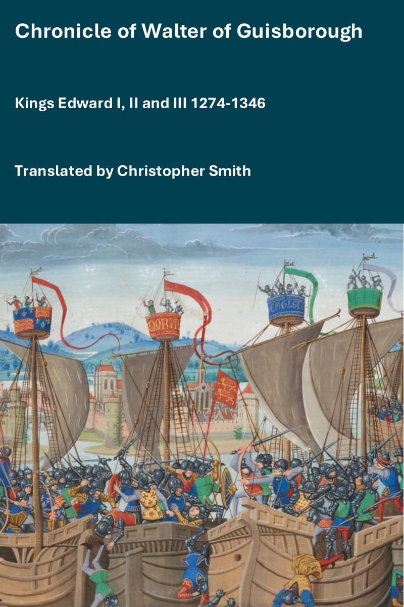
The Chronicle of Walter of Guisborough, a canon regular of the Augustinian Guisborough Priory, Yorkshire, formerly known as The Chronicle of Walter of Hemingburgh, describes the period from 1066 to 1346. Before 1274 the Chronicle is based on other works. Thereafter, the Chronicle is original, and a remarkable source for the events of the time. This book provides a translation of the Chronicle from that date. The Latin source for our translation is the 1849 work edited by Hans Claude Hamilton. Hamilton, in his preface, says: "In the present work we behold perhaps one of the finest samples of our early chronicles, both as regards the value of the events recorded, and the correctness with which they are detailed; Nor will the pleasing style of composition be lightly passed over by those capable of seeing reflected from it the tokens of a vigorous and cultivated mind, and a favourable specimen of the learning and taste of the age in which it was framed." Available at Amazon in eBook and Paperback.
Colt Hoare 1812. No. 80 [Durrington Barrow 80 G21a [Map]] is not sepulchral.
Durrington Barrow 81 G21, Durrington Barrows, Stonehenge Barrows, Stonehenge Landscape, Amesbury Hundred, Wiltshire, South-West England, British Isles [Map]
Colt Hoare 1812. No. 81 [In Durrington Barrow 81 G21 [Map]] we discovered a large rude urn, containing an interment of burned bones.
Durrington Barrow 82 G20, Durrington Barrows, Stonehenge Barrows, Stonehenge Landscape, Amesbury Hundred, Wiltshire, South-West England, British Isles [Map]
Colt Hoare 1812. No. 82 [Durrington Barrow 82 G20 [Map]] had a cinerarium, and two simple interments of burned bones, just under the surface.
Durrington Barrow 83 G18, Durrington Barrows, Stonehenge Barrows, Stonehenge Landscape, Amesbury Hundred, Wiltshire, South-West England, British Isles [Map]
Colt Hoare 1812. No. 83 [Durrington Barrow 83 G18 [Map]] contained a sepulchral urn, with a small brass pin.
Durrington Barrow 84 G25, Durrington Barrows, Stonehenge Barrows, Stonehenge Landscape, Amesbury Hundred, Wiltshire, South-West England, British Isles [Map]
Colt Hoare 1812. No. 84 [Durrington Barrow 84 G25 [Map]] is the largest barrow in this group, and has been ploughed over. In making our section, we found pieces of stag's horns, pottery, and the remains of a skeleton and drinking cup, and two knives; but the primary interment was a skeleton, with its legs gathered up, and hands placed under its head.
Durrington Barrow 85 G26, Durrington Barrows, Stonehenge Barrows, Stonehenge Landscape, Amesbury Hundred, Wiltshire, South-West England, British Isles [Map]
Colt Hoare 1812. No. 85 [Durrington Barrow 85 G26 [Map]] contained originally an interment of burned bones, within a cist, but had been opened.
Durrington Barrow 86 G27, Durrington Barrows, Stonehenge Barrows, Stonehenge Landscape, Amesbury Hundred, Wiltshire, South-West England, British Isles [Map]
Colt Hoare 1812. No. 86 [Durrington Barrow 86 G27 [Map]] had also experienced the same investigation; it had a circular cist, and a cinerarium.
Durrington Barrow 88 G29, Durrington Barrows, Stonehenge Barrows, Stonehenge Landscape, Amesbury Hundred, Wiltshire, South-West England, British Isles [Map]
All About History Books
The Chronicle of Walter of Guisborough, a canon regular of the Augustinian Guisborough Priory, Yorkshire, formerly known as The Chronicle of Walter of Hemingburgh, describes the period from 1066 to 1346. Before 1274 the Chronicle is based on other works. Thereafter, the Chronicle is original, and a remarkable source for the events of the time. This book provides a translation of the Chronicle from that date. The Latin source for our translation is the 1849 work edited by Hans Claude Hamilton. Hamilton, in his preface, says: "In the present work we behold perhaps one of the finest samples of our early chronicles, both as regards the value of the events recorded, and the correctness with which they are detailed; Nor will the pleasing style of composition be lightly passed over by those capable of seeing reflected from it the tokens of a vigorous and cultivated mind, and a favourable specimen of the learning and taste of the age in which it was framed." Available at Amazon in eBook and Paperback.
Colt Hoare 1812. No. 88 [Durrington Barrow 88 G29 [Map]]. A similar, but finer barrow: produced near the surface, just under the turf, the fragments of a rude urn and burned bones, and lower down, a sepulchral urn reversed over a deposit of burned bones.
Durrington Barrow 89 G32, Durrington Barrows, Stonehenge Barrows, Stonehenge Landscape, Amesbury Hundred, Wiltshire, South-West England, British Isles [Map]
Colt Hoare 1812. No. 89 [Durrington Barrow 89 G32 [Map]] has been in tillage: it contained a skeleton, placed in a long circnlar cist, with its head towards the north,
Durrington Barrow 90 G33, Durrington Barrows, Stonehenge Barrows, Stonehenge Landscape, Amesbury Hundred, Wiltshire, South-West England, British Isles [Map]
Colt Hoare 1812. No. 90 [Durrington Barrow 90 G33 [Map]], in tillage, produced a large urn rudely ornamented, and inverted over a deposit of burned bones,
Durrington Barrow 91 G34, Durrington Barrows, Stonehenge Barrows, Stonehenge Landscape, Amesbury Hundred, Wiltshire, South-West England, British Isles [Map]
Colt Hoare 1812. No. 91 [Durrington Barrow 91 G34 [Map]] contained an interment of burned bones, deposited on the floor of the barrow; and beneath it was a deep cist, containing abundance of ashes and charred wood, intermixed with particles of bone.
Durrington Barrow 92 G35, Durrington Barrows, Stonehenge Barrows, Stonehenge Landscape, Amesbury Hundred, Wiltshire, South-West England, British Isles [Map]
Colt Hoare 1812. No. 92 [Durrington Barrow 92 G35 [Map]]. In digging down to the floor of this barrow, we discovered the remains of a skeleton, with fragments of a funeral urn, burned bones, and some enormous pieces of staff's horns. Within a cist, excavated beneath the floor of the barrow, lay a skeleton with its legs gathered up, and head placed towards the north.
Durrington Barrow 93 G36, Durrington Barrows, Stonehenge Barrows, Stonehenge Landscape, Amesbury Hundred, Wiltshire, South-West England, British Isles [Map]

Colt Hoare 1812. No. 93 [Durrington Barrow 93 G36 [Map]] contained, near the top, an interment of burned bones, in a rude broken urn, with a small cup; also, the remains of a skeleton, charred wood, stag's horns, and flint apparently prepared for war-like instruments. The primary deposit was a skeleton, with its head placed towards the south-east, accompanied by fine drinking cap, richly ornamented, and in the highest state of preservation, which I have had engraved in Tumuli Plate XVIII. half the size of the original, in order to shew the pattern more conspicuously.

Wiltshire Museum. DZSWS:STHEAD.30. Long Necked Beaker decorated with a band of chevrons bordered by lines around the rim, below the waist and around the base, a band of lozenge shapes around neck and cross-hatching around the body, all using comb and fingernail impressions, found with a primary inhumation in bowl barrow Durrington G36 [Map], excavated by William Cunnington.

Wiltshire Museum. DZSWS:STHEAD.240. 1 miniature cup with two shoulder ridges, found with an (MBA) collared urn and secondary cremation in bowl barrow Durrington G36 [Map], excavated by William Cunnington.
Durrington Barrow 94 G37b, Durrington Barrows, Stonehenge Barrows, Stonehenge Landscape, Amesbury Hundred, Wiltshire, South-West England, British Isles [Map]
Durrington Barrow 95 G37a, Durrington Barrows, Stonehenge Barrows, Stonehenge Landscape, Amesbury Hundred, Wiltshire, South-West England, British Isles [Map]
Durrington Barrow 96 G37, Durrington Barrows, Stonehenge Barrows, Stonehenge Landscape, Amesbury Hundred, Wiltshire, South-West England, British Isles [Map]
Durrington Barrow 97 G66, Durrington Barrows, Stonehenge Barrows, Stonehenge Landscape, Amesbury Hundred, Wiltshire, South-West England, British Isles [Map]
Durrington Barrow 98 G57, Durrington Barrows, Stonehenge Barrows, Stonehenge Landscape, Amesbury Hundred, Wiltshire, South-West England, British Isles [Map]
All About History Books
The Chronicle of Walter of Guisborough, a canon regular of the Augustinian Guisborough Priory, Yorkshire, formerly known as The Chronicle of Walter of Hemingburgh, describes the period from 1066 to 1346. Before 1274 the Chronicle is based on other works. Thereafter, the Chronicle is original, and a remarkable source for the events of the time. This book provides a translation of the Chronicle from that date. The Latin source for our translation is the 1849 work edited by Hans Claude Hamilton. Hamilton, in his preface, says: "In the present work we behold perhaps one of the finest samples of our early chronicles, both as regards the value of the events recorded, and the correctness with which they are detailed; Nor will the pleasing style of composition be lightly passed over by those capable of seeing reflected from it the tokens of a vigorous and cultivated mind, and a favourable specimen of the learning and taste of the age in which it was framed." Available at Amazon in eBook and Paperback.
Durrington Barrow 99 G58, Durrington Barrows, Stonehenge Barrows, Stonehenge Landscape, Amesbury Hundred, Wiltshire, South-West England, British Isles [Map]
Durrington Barrow 100 G51, Durrington Barrows, Stonehenge Barrows, Stonehenge Landscape, Amesbury Hundred, Wiltshire, South-West England, British Isles [Map]
Colt Hoare 1812. No. 100 [Durrington Barrow 100 G51 [Map]] contained a simple interment of burned bones within a circular cist.
Durrington Barrow 101 G47, Durrington Barrows, Stonehenge Barrows, Stonehenge Landscape, Amesbury Hundred, Wiltshire, South-West England, British Isles [Map]
Colt Hoare 1812. No. 101 [Durrington Barrow 101 G47 [Map]], a similar interment, accompanied with two black rings of some bituminous substance, and one pully bead.
Durrington Barrow 102 G48, Durrington Barrows, Stonehenge Barrows, Stonehenge Landscape, Amesbury Hundred, Wiltshire, South-West England, British Isles [Map]
Colt Hoare 1812. No. 102 [Durrington Barrow 102 G48 [Map]], an interment of burned bones in a cist, with remnants of the cloth in which the relicts were enveloped.
Durrington Barrow 103 G49, Durrington Barrows, Stonehenge Barrows, Stonehenge Landscape, Amesbury Hundred, Wiltshire, South-West England, British Isles [Map]
Colt Hoare 1812. No. 103 [Durrington Barrow 103 G49 [Map]], a deep circular cist with ashes.
Durrington Barrow 104 G50, Durrington Barrows, Stonehenge Barrows, Stonehenge Landscape, Amesbury Hundred, Wiltshire, South-West England, British Isles [Map]
Colt Hoare 1812. No. 104 [Durrington Barrow 104 G50 [Map]] is a large flat circular barrow, which had been opened, and must have proved both interesting and productive to those who first investigated it. In the course of our examination, we found the bones of several skeletons, fragments of urns, and a rude instrument made from a stag's horn; there was also a large and deep cist.

Wiltshire Museum. DZSWS:STHEAD.101. 1 perforated antler pick (ground to an edge at the point and perforated for a handle at the larger end) found with a primary or secondary inhumation in bowl barrow Durrington G50 [Map], excavated by William Cunnington.
Durrington Barrow 105 G52, Durrington Barrows, Stonehenge Barrows, Stonehenge Landscape, Amesbury Hundred, Wiltshire, South-West England, British Isles [Map]
Colt Hoare 1812. No. 105 [Durrington Barrow 105 G52 [Map]] and No. 106 [Map] had been opened by others.
Durrington Barrow 106 G54, Durrington Barrows, Stonehenge Barrows, Stonehenge Landscape, Amesbury Hundred, Wiltshire, South-West England, British Isles [Map]
Colt Hoare 1812. No. 105 [Durrington Barrow 105 G52 [Map]] and No. 106 [Map] had been opened by others.
Durrington Barrow 107 G53, Durrington Barrows, Stonehenge Barrows, Stonehenge Landscape, Amesbury Hundred, Wiltshire, South-West England, British Isles [Map]
Colt Hoare 1812. No. 107 [Durrington Barrow 107 G53 [Map]] produced a small interment of burned bones, with a pin of bone at top, and under it, a pile of ashes in a cist.
Durrington Barrow 108 G51a, Durrington Barrows, Stonehenge Barrows, Stonehenge Landscape, Amesbury Hundred, Wiltshire, South-West England, British Isles [Map]
Colt Hoare 1812. No. 108 [Durrington Barrow 108 G51a [Map]] is a pond barrow.
Durrington Barrow 109 G40, Durrington Barrows, Stonehenge Barrows, Stonehenge Landscape, Amesbury Hundred, Wiltshire, South-West England, British Isles [Map]
Colt Hoare 1812. No. 109 [Durrington Barrow 109 G40 [Map]], No. 110 [Map], and No. 111 [Map], had been investigated: on opening the first, we found the soil intermixed with the turf, which clearly indicated a prior opening, We were deterred from making any attempt on the second barrow, by a great cavity in its apex; and we found the third had been examined.
Durrington Barrow 110 G41, Durrington Barrows, Stonehenge Barrows, Stonehenge Landscape, Amesbury Hundred, Wiltshire, South-West England, British Isles [Map]
All About History Books
The Chronicle of Walter of Guisborough, a canon regular of the Augustinian Guisborough Priory, Yorkshire, formerly known as The Chronicle of Walter of Hemingburgh, describes the period from 1066 to 1346. Before 1274 the Chronicle is based on other works. Thereafter, the Chronicle is original, and a remarkable source for the events of the time. This book provides a translation of the Chronicle from that date. The Latin source for our translation is the 1849 work edited by Hans Claude Hamilton. Hamilton, in his preface, says: "In the present work we behold perhaps one of the finest samples of our early chronicles, both as regards the value of the events recorded, and the correctness with which they are detailed; Nor will the pleasing style of composition be lightly passed over by those capable of seeing reflected from it the tokens of a vigorous and cultivated mind, and a favourable specimen of the learning and taste of the age in which it was framed." Available at Amazon in eBook and Paperback.
Colt Hoare 1812. No. 109 [Durrington Barrow 109 G40 [Map]], No. 110 [Map], and No. 111 [Map], had been investigated: on opening the first, we found the soil intermixed with the turf, which clearly indicated a prior opening, We were deterred from making any attempt on the second barrow, by a great cavity in its apex; and we found the third had been examined.
Durrington Barrow 111 G42, Durrington Barrows, Stonehenge Barrows, Stonehenge Landscape, Amesbury Hundred, Wiltshire, South-West England, British Isles [Map]
Colt Hoare 1812. No. 109 [Durrington Barrow 109 G40 [Map]], No. 110 [Map], and No. 111 [Map], had been investigated: on opening the first, we found the soil intermixed with the turf, which clearly indicated a prior opening, We were deterred from making any attempt on the second barrow, by a great cavity in its apex; and we found the third had been examined.
Durrington Barrow 112 G43, Durrington Barrows, Stonehenge Barrows, Stonehenge Landscape, Amesbury Hundred, Wiltshire, South-West England, British Isles [Map]
Colt Hoare 1812. No. 112 [Durrington Barrow 112 G43 [Map]] is a double barrow, rising towards the east, and somewhat resembling a long barrow, but ditched all around. The lowest part had been opened, and contained an interment of burned bones. In the other mound, we found an interment of burned bones, secored by a linen cloth under a rude urn.
Durrington Barrow 113 G44, Durrington Barrows, Stonehenge Barrows, Stonehenge Landscape, Amesbury Hundred, Wiltshire, South-West England, British Isles [Map]
Colt Hoare 1812. No. 113 [Durrington Barrow 113 G44 [Map]] had been examined before, but we found in it fragments of an urn and skeleton.
Durrington Barrow 114 G45, Durrington Barrows, Stonehenge Barrows, Stonehenge Landscape, Amesbury Hundred, Wiltshire, South-West England, British Isles [Map]
Colt Hoare 1812. No. 114 [Durrington Barrow 114 G45 [Map]] contained a deposit of burned bones and ashes, in a deep cist.
Durrington Barrow 116 G62a, Durrington Barrows, Stonehenge Barrows, Stonehenge Landscape, Amesbury Hundred, Wiltshire, South-West England, British Isles [Map]
Colt Hoare 1812. No. 116 [Durrington Barrow 116 G62a [Map]] had been opened before.
Durrington Barrow 117 G60, Durrington Barrows, Stonehenge Barrows, Stonehenge Landscape, Amesbury Hundred, Wiltshire, South-West England, British Isles [Map]
Colt Hoare 1812. No. 117 [Durrington Barrow 117 G60 [Map]] contained a small rude urn, with an interment of burned bones.
Durrington Barrow 118 G61, Durrington Barrows, Stonehenge Barrows, Stonehenge Landscape, Amesbury Hundred, Wiltshire, South-West England, British Isles [Map]
Colt Hoare 1812. No. 118 [Durrington Barrow 118 G61 [Map]] is a small long barrow, and produced a deposit of burned bones and black ashes in a neat circular cist.
Durrington Barrow 119 G62, Durrington Barrows, Stonehenge Barrows, Stonehenge Landscape, Amesbury Hundred, Wiltshire, South-West England, British Isles [Map]
Colt Hoare 1812. No. 119 [Durrington Barrow 119 G62 [Map]] contained an interment of burned bones in a small cist.
Durrington Barrow 120 G62b, Durrington Barrows, Stonehenge Barrows, Stonehenge Landscape, Amesbury Hundred, Wiltshire, South-West England, British Isles [Map]
Colt Hoare 1812. No. 120 [Durrington Barrow 120 G62b [Map]] is a pond barrow; and No. 121 [Map] produced a rude urn reversed over a deposit of burned bones.
Durrington Barrow 121 G62c, Durrington Barrows, Stonehenge Barrows, Stonehenge Landscape, Amesbury Hundred, Wiltshire, South-West England, British Isles [Map]
Colt Hoare 1812. No. 120 [Durrington Barrow 120 G62b [Map]] is a pond barrow; and No. 121 [Map] produced a rude urn reversed over a deposit of burned bones.
Durrington Barrow 122 G65a, Durrington Barrows, Stonehenge Barrows, Stonehenge Landscape, Amesbury Hundred, Wiltshire, South-West England, British Isles [Map]
Colt Hoare 1812. On the south side of Durrington Walls, is an elevated mound, bearing the appearance of a barrow, No. 122 [Durrington Barrow 122 G65a [Map]], in which we dug to the depth of eleven feet, but found no sepulchral marks whatever.
Durrington Barrow 123 G65b, Durrington Barrows, Stonehenge Barrows, Stonehenge Landscape, Amesbury Hundred, Wiltshire, South-West England, British Isles [Map]
Colt Hoare 1812. A little further on the right of the road leading to Amesbury, we see the mutilated remains of an enormous Druid barrow, No. 123 [Durrington Barrow 123 G65b [Map]].
Durrington Barrow 124 G65c, Durrington Barrows, Stonehenge Barrows, Stonehenge Landscape, Amesbury Hundred, Wiltshire, South-West England, British Isles [Map]
Colt Hoare 1812. And still further, on the same side of the road, a very singular tumulus, No. 124 [Map], appearing like three barrows rising from one large base, but certainly a long barrow. It stands from south-west to north-east, and has its wide end towards the west: on the small end, and also on the centre, are mounds resembling two circular barrows. We opened that on the small end, and found only a few ashes and charred wood; but in the central mound we discovered, near the top, a skeleton and a drinking cup, both of which had been disturbed. On reaching the floor of the long barrow, we found a circular cist like a little well, but it contained no interment; from this well-like cist, a tunnel, like a chimney, ascended nearly to the top. I imagine that, as in most of our long barrows, the primary interment would be found at the broad end. In this tumulus we have rather a singular instance of a circular barrow being raised upon a long barrow.

Wiltshire Museum. DZSWS:STHEAD.92. 1 Aldbourne (incense?) cup (distorted by pressure) perforated twice for suspension and decorated with a band of incised zigzags around the flared inner lip and chevrons around the outside of the lip (every other zigzag or chevron of which contained impressed dots) and two bands around the waist - one plain and one with chevrons (below which are a line of dots), found with a primary (?) cremation in bowl barrow Durrington G65c [Map], excavated by William Cunnington.
Durrington Barrow 125 G38a, Durrington Barrows, Stonehenge Barrows, Stonehenge Landscape, Amesbury Hundred, Wiltshire, South-West England, British Isles [Map]
Colt Hoare 1812. No. 125 [Durrington Barrow 125 G38a [Map]], in tillage, appears to have been barrow of very large proportions, and there are two others in the corn fields nearer the park, No. 126 [Map], No. 127 [Map], which we have not attempted to open. There are also near them under the hill; same appearances of earthen works much mutilated, which I cannot account for: I once thought they formed part of circle, but I cannot speak with any decision about them.
Durrington Barrow 126 G39b, Durrington Barrows, Stonehenge Barrows, Stonehenge Landscape, Amesbury Hundred, Wiltshire, South-West England, British Isles [Map]
Colt Hoare 1812. No. 125 [Durrington Barrow 125 G38a [Map]], in tillage, appears to have been barrow of very large proportions, and there are two others in the corn fields nearer the park, No. 126 [Map], No. 127 [Map], which we have not attempted to open. There are also near them under the hill; same appearances of earthen works much mutilated, which I cannot account for: I once thought they formed part of circle, but I cannot speak with any decision about them.
Durrington Barrow 127 G39c, Durrington Barrows, Stonehenge Barrows, Stonehenge Landscape, Amesbury Hundred, Wiltshire, South-West England, British Isles [Map]
Colt Hoare 1812. No. 125 [Durrington Barrow 125 G38a [Map]], in tillage, appears to have been barrow of very large proportions, and there are two others in the corn fields nearer the park, No. 126 [Map], No. 127 [Map], which we have not attempted to open. There are also near them under the hill; same appearances of earthen works much mutilated, which I cannot account for: I once thought they formed part of circle, but I cannot speak with any decision about them.