Text this colour links to Pages. Text this colour links to Family Trees. Text this colour are links that are disabled for Guests.
Place the mouse over images to see a larger image. Click on paintings to see the painter's Biography Page. Mouse over links for a preview. Move the mouse off the painting or link to close the popup.
All About History Books
The Chronicle of Abbot Ralph of Coggeshall describes the reigns of Kings Henry II, Richard I, John and Henry III, providing a wealth of information about their lives and the events of the time. Ralph's work is detailed, comprehensive and objective. We have augmented Ralph's text with extracts from other contemporary chroniclers to enrich the reader's experience. Available at Amazon in eBook and Paperback.
Gunthorpe, Nottinghamshire is in Nottinghamshire.
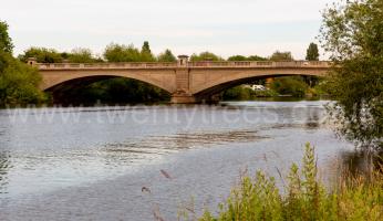
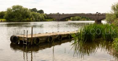
Gunthorpe Bridge, Nottinghamshire, North-Central England, British Isles [Map]
Gunthorpe Bridge, Nottinghamshire [Map] is a bridge over the River Trent which replaced a ferry which operated until 1875. The original bridge opened in 1875. It was built largely in iron. The current bridge was built in 1927 400 metres upstream from the old one.
The River Trent rises on Biddulph Moor, Staffordshire [Map] and flows, in a great horseshoe through, or near, Stoke-on-Trent, Staffordshire [Map], Stone, Staffordshire [Map], Essex Bridge [Map], Bishton Hall, Staffordshire [Map], Colwich, Staffordshire [Map] passing St Michael and All Angels Church, Colwich [Map], Rugeley, Staffordshire [Map], Kings Bromley, Staffordshire [Map], Alrewas, Staffordshire [Map], Burton-upon-Trent, Staffordshire [Map], Newton Solney, Derbyshire [Map], Repton, Derbyshire [Map], under Swarkestone Bridge, Derbyshire [Map], Sawley, Derbyshire [Map], Nottingham, Nottinghamshire [Map], Holme Pierrepoint, Nottinghamshire [Map], Stoke Ferry, Shelford [Map], under Gunthorpe Bridge, Nottinghamshire [Map], past Gunthorpe Lock [Map], Hoveringham, Nottingham [Map], Newark on Trent, Nottinghamshire [Map], Knaith [Map], Dunham Bridge [Map], Sutton on Trent, Nottinghamshire [Map], the Isle of Axholme [Map] and Gainsborough [Map] before joining the Humber Estuary at Trent Falls [Map].
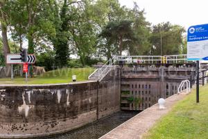
Gunthorpe Lock, Nottinghamshire, North-Central England, British Isles [Map]
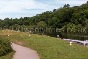
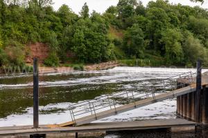
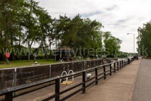
Gunthorpe Lock [Map] is a lock and weir on the River Trent.
The River Trent rises on Biddulph Moor, Staffordshire [Map] and flows, in a great horseshoe through, or near, Stoke-on-Trent, Staffordshire [Map], Stone, Staffordshire [Map], Essex Bridge [Map], Bishton Hall, Staffordshire [Map], Colwich, Staffordshire [Map] passing St Michael and All Angels Church, Colwich [Map], Rugeley, Staffordshire [Map], Kings Bromley, Staffordshire [Map], Alrewas, Staffordshire [Map], Burton-upon-Trent, Staffordshire [Map], Newton Solney, Derbyshire [Map], Repton, Derbyshire [Map], under Swarkestone Bridge, Derbyshire [Map], Sawley, Derbyshire [Map], Nottingham, Nottinghamshire [Map], Holme Pierrepoint, Nottinghamshire [Map], Stoke Ferry, Shelford [Map], under Gunthorpe Bridge, Nottinghamshire [Map], past Gunthorpe Lock [Map], Hoveringham, Nottingham [Map], Newark on Trent, Nottinghamshire [Map], Knaith [Map], Dunham Bridge [Map], Sutton on Trent, Nottinghamshire [Map], the Isle of Axholme [Map] and Gainsborough [Map] before joining the Humber Estuary at Trent Falls [Map].