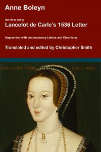
Anne Boleyn. Her Life as told by Lancelot de Carle's 1536 Letter.
In 1536, two weeks after the execution of Anne Boleyn, her brother George and four others, Lancelot du Carle, wrote an extraordinary letter that described Anne's life, and her trial and execution, to which he was a witness. This book presents a new translation of that letter, with additional material from other contemporary sources such as Letters, Hall's and Wriothesley's Chronicles, the pamphlets of Wynkyn the Worde, the Memorial of George Constantyne, the Portuguese Letter and the Baga de Secrets, all of which are provided in Appendices.
Available at Amazon in eBook and Paperback format.
South Kesteven is in Kesteven.
Around 50AD. Ancaster [Map] was the junction of Ermine Street and King Street. During the Romano-British period, the Romans built a roadside settlement on the site of a
King Street is a Roman Road between Peterborough [Map] and Ancaster [Map] where it joins Ermine Street 2. It is numbered 26 in Ivan Margary's book 'Roman Roads in Britain'.
From Peterborough [Map] it travels north through Lolham Bridges [Map] crossing the River Glen at Kates Bridge [Map], through Bourne where Bourne Abbey, Lincolnshire [Map] was later built. The road continues through Cawthorpe [Map], Stainfield, South Kesteven [Map], Hanby, South Kesteven [Map], Sapperton, South Kesteven [Map] before reaching Ermine Street 2 south of Ancaster [Map].
Ermine Street. From Durobrivae [Map] Ermine Street crosses the River Welland at Stamford [Map] then continues through Great Casterton [Map], Colsterworth [Map], Ancaster [Map]. Continuing on a new alignment Ermine Street passes east of Navenby [Map] meeting the Fosse Way at Bracebridge [Map] with both roads continuing together to Lindum Colonia [Map] aka Lincoln.
In 913 Charles Noel Allix sold Willoughby Hall.
In 1794 Charles Allix [aged 78] died. Reverend Charles Wager Allix [aged 46] inherited Willoughby Hall. John Peter Allix [aged 45] inherited Swaffham Prior House.
In 1795 Reverend Charles Wager Allix [aged 47] died. Colonel Charles Allix [aged 11] inherited Willoughby Hall.
On 9th April 1823 Captain William Kent Allix was born to Colonel Charles Allix [aged 40] and Mary Elizabeth Hammond at Willoughby Hall. He was educated at Harrow School where there is a memorial plaque to him.
On 22nd January 1866 Colonel Charles Allix [aged 83] died. He was buried at St Martin's Church, Ancaster [Map]. Frederick William Allix [aged 49] inherited Willoughby Hall.
On 13th October 1894 Frederick William Allix [aged 78] died. Charles Noel Allix [aged 48] inherited Willoughby Hall.
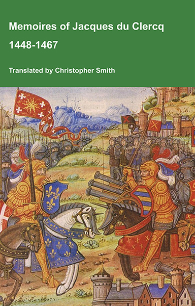
This is a translation of the 'Memoires of Jacques du Clercq', published in 1823 in two volumes, edited by Frederic, Baron de Reissenberg. In his introduction Reissenberg writes: 'Jacques du Clercq tells us that he was born in 1424, and that he was a licentiate in law and a counsellor to Philip the Good, Duke of Burgundy, in the castellany of Douai, Lille, and Orchies. It appears that he established his residence at Arras. In 1446, he married the daughter of Baldwin de la Lacherie, a gentleman who lived in Lille. We read in the fifth book of his Memoirs that his father, also named Jacques du Clercq, had married a lady of the Le Camelin family, from Compiègne. His ancestors, always attached to the counts of Flanders, had constantly served them, whether in their councils or in their armies.' The Memoires cover a period of nineteen years beginning in in 1448, ending in in 1467. It appears that the author had intended to extend the Memoirs beyond that date; no doubt illness or death prevented him from carrying out this plan. As Reissenberg writes the 'merit of this work lies in the simplicity of its narrative, in its tone of good faith, and in a certain air of frankness which naturally wins the reader’s confidence.' Du Clercq ranges from events of national and international importance, including events of the Wars of the Roses in England, to simple, everyday local events such as marriages, robberies, murders, trials and deaths, including that of his own father in Book 5; one of his last entries.
Available at Amazon in eBook and Paperback format.
The River Witham rises near South Witham, South Kesteven [Map] from where it flows past North Witham, South Kesteven [Map], Colsterworth, South Kesteven [Map], Easton, South Kesteven [Map] to Great Ponton, South Kesteven [Map] where it is joined by the Cringle Brook.
From Great Ponton, South Kesteven [Map] the River Witham flows through Grantham [Map], Belton, Grantham [Map], past Barkston, South Kesteven [Map], Marston, South Kesteven [Map] and Hougham, South Kesteven [Map], Westborough, South Kesteven [Map], Long Benington, South Kesteven [Map], Claypole, South Kesteven [Map], Beckingham, North Kesteven [Map], Norton Disney, North Kesteven [Map], Bassingham, North Kesteven [Map], Haddington, North Kesteven [Map], Aubourn, North Kesteven [Map] through the centre of Lincoln, Lincolnshire [Map] where it joined by the River Till.
From Lincoln, Lincolnshire [Map] it flows under Five Mile Bridge [Map], past Bardney Abbey [Map], Kirkstead [Map], under Tattershall Bridge [Map] after which it is joined by the River Bain
After Tattershall the River Witham flows through canalised sections under Lanrick Bridge [Map], past Anton's Gowt [Map] to Boston [Map] where it is joined by the South Forty Foot Drain. After Boston [Map] the River Witham flows into the The Wash around eight kilometres away.

The South Forty Foot Drain aka Black Sluice is a man-made drain starting at Guthram Gowt [Map] that drains a large area of the Lincolnshire fen-land known as the Black Sluice Area aka Lindsey Level. The drain, or an early version of it was first constructed around 1635 when the Earl of Lindsey agreed with the Commissioners of Sewers for Lincolnshire to carry out drainage works which would make 150 km2 of land available for agricultural use. The South Forty Foot Drain drains the area bounded by Great Hale, North Kesteven [Map], Bourne, South Kesteven [Map], Pinchbeck [Map] and Boston [Map].
Bytham Castle, Lincolnshire is also in Castles in Lincolnshire.

Bytham Castle, Lincolnshire [Map] is (probably) a Norman Castle of Motte and Bailey construction. No stonework remains above ground
Photo by Richard Carter, CC BY-SA 2.0.
On 12th May 1335 Margery de Braose [aged 70] died at Bytham Castle, Lincolnshire [Map].
The River Witham rises near South Witham, South Kesteven [Map] from where it flows past North Witham, South Kesteven [Map], Colsterworth, South Kesteven [Map], Easton, South Kesteven [Map] to Great Ponton, South Kesteven [Map] where it is joined by the Cringle Brook.
From Great Ponton, South Kesteven [Map] the River Witham flows through Grantham [Map], Belton, Grantham [Map], past Barkston, South Kesteven [Map], Marston, South Kesteven [Map] and Hougham, South Kesteven [Map], Westborough, South Kesteven [Map], Long Benington, South Kesteven [Map], Claypole, South Kesteven [Map], Beckingham, North Kesteven [Map], Norton Disney, North Kesteven [Map], Bassingham, North Kesteven [Map], Haddington, North Kesteven [Map], Aubourn, North Kesteven [Map] through the centre of Lincoln, Lincolnshire [Map] where it joined by the River Till.
From Lincoln, Lincolnshire [Map] it flows under Five Mile Bridge [Map], past Bardney Abbey [Map], Kirkstead [Map], under Tattershall Bridge [Map] after which it is joined by the River Bain
After Tattershall the River Witham flows through canalised sections under Lanrick Bridge [Map], past Anton's Gowt [Map] to Boston [Map] where it is joined by the South Forty Foot Drain. After Boston [Map] the River Witham flows into the The Wash around eight kilometres away.
Around 1435 Joan Beaumont Baroness Lovel was born to John Beaumont 1st Viscount Beaumont [aged 25] and Katherine Neville Duchess Norfolk [aged 35] at Edenham, South Kesteven. She a great x 2 granddaughter of King Edward III of England. She married (1) before 1456 her second cousin once removed John Lovell 8th Baron Lovel 5th Baron Holand, son of William Lovell 7th Baron Lovel 4th Baron Holand and Alice Deincourt 6th Baroness Deincourt and Grey, Baroness Lovel and Sudeley, and had issue (2) after 28th February 1463 her half third cousin once removed William Stanley, son of Thomas Stanley 1st Baron Stanley and Jane Goushill Baroness Stanley.
On 22nd July 1779 Robert Bertie 4th Duke Ancaster and Kesteven [deceased] was buried at Edenham, South Kesteven.
The River Witham rises near South Witham, South Kesteven [Map] from where it flows past North Witham, South Kesteven [Map], Colsterworth, South Kesteven [Map], Easton, South Kesteven [Map] to Great Ponton, South Kesteven [Map] where it is joined by the Cringle Brook.
From Great Ponton, South Kesteven [Map] the River Witham flows through Grantham [Map], Belton, Grantham [Map], past Barkston, South Kesteven [Map], Marston, South Kesteven [Map] and Hougham, South Kesteven [Map], Westborough, South Kesteven [Map], Long Benington, South Kesteven [Map], Claypole, South Kesteven [Map], Beckingham, North Kesteven [Map], Norton Disney, North Kesteven [Map], Bassingham, North Kesteven [Map], Haddington, North Kesteven [Map], Aubourn, North Kesteven [Map] through the centre of Lincoln, Lincolnshire [Map] where it joined by the River Till.
From Lincoln, Lincolnshire [Map] it flows under Five Mile Bridge [Map], past Bardney Abbey [Map], Kirkstead [Map], under Tattershall Bridge [Map] after which it is joined by the River Bain
After Tattershall the River Witham flows through canalised sections under Lanrick Bridge [Map], past Anton's Gowt [Map] to Boston [Map] where it is joined by the South Forty Foot Drain. After Boston [Map] the River Witham flows into the The Wash around eight kilometres away.
The History of William Marshal was commissioned by his son shortly after William’s death in 1219 to celebrate the Marshal’s remarkable life; it is an authentic, contemporary voice. The manuscript was discovered in 1861 by French historian Paul Meyer. Meyer published the manuscript in its original Anglo-French in 1891 in two books. This book is a line by line translation of the first of Meyer’s books; lines 1-10152. Book 1 of the History begins in 1139 and ends in 1194. It describes the events of the Anarchy, the role of William’s father John, John’s marriages, William’s childhood, his role as a hostage at the siege of Newbury, his injury and imprisonment in Poitou where he met Eleanor of Aquitaine and his life as a knight errant. It continues with the accusation against him of an improper relationship with Margaret, wife of Henry the Young King, his exile, and return, the death of Henry the Young King, the rebellion of Richard, the future King Richard I, war with France, the death of King Henry II, and the capture of King Richard, and the rebellion of John, the future King John. It ends with the release of King Richard and the death of John Marshal.
Available at Amazon in eBook and Paperback format.
The Cringle Brook near Buckminster, Leicestershire [Map] from where it flows past Skillington, South Kesteven [Map] and Stoke Rochford [Map] before joining the River Witham at Great Ponton, South Kesteven [Map].
King Street is a Roman Road between Peterborough [Map] and Ancaster [Map] where it joins Ermine Street 2. It is numbered 26 in Ivan Margary's book 'Roman Roads in Britain'.
From Peterborough [Map] it travels north through Lolham Bridges [Map] crossing the River Glen at Kates Bridge [Map], through Bourne where Bourne Abbey, Lincolnshire [Map] was later built. The road continues through Cawthorpe [Map], Stainfield, South Kesteven [Map], Hanby, South Kesteven [Map], Sapperton, South Kesteven [Map] before reaching Ermine Street 2 south of Ancaster [Map].
Honington, South Kesteven.
Our church is open for visitors and individual prayer from 9 am to 4 pm each day
Monument to Sir William Hussey, d.1691.
"In Memory Of Sarah Hussey Wife Of Robert Ap Reece, Of Washingley, In The County Of Huntingdon, Esqre. She Was The Daughter And Heir Of Sir Thomas Hussey Of Huntingdon, Bart. Descended From The 2nd Brother Of The Right Honble. John, Lord Hussey, Baron Of Sleeford, And Lord Lieutenant Of The County Of Lincoln. This Family Did Derive Their Descent From The Ancient Barons Hoese, Or Huse: Temp. Hen. Iii. And Edw. I. Ii. & Iii. She Died The 23d Of April, 1749."
Portrait bust of Sir Thomas Hussey bart., d.1698.
"On the north wall, monuments to Sir William Hussey, d.1691 and Dame Sarah Hussey d.1697 with broken pediment, scrolly cartouches and cherubs"
"Monuments:- those in the north aisle are a notable collection; on the east wall is a marble plaque to Sir Thomas Hussey bart., d.1698 with a gadrooned base supporting a portrait bust and surmounted by a scrolly cartouche bearing a shield of arms. On the north wall, monuments to Sir William Hussey, d.1691 and Dame Sarah Hussey d.1697 with broken pediment, scrolly cartouches and cherubs. Also an altar tomb in the north east angle of the chapel to Thomas Hussey, son of Sir Thomas, d.1676 aged 15 years, black marble ledger slab above limestone tomb chest"
The River Witham rises near South Witham, South Kesteven [Map] from where it flows past North Witham, South Kesteven [Map], Colsterworth, South Kesteven [Map], Easton, South Kesteven [Map] to Great Ponton, South Kesteven [Map] where it is joined by the Cringle Brook.
From Great Ponton, South Kesteven [Map] the River Witham flows through Grantham [Map], Belton, Grantham [Map], past Barkston, South Kesteven [Map], Marston, South Kesteven [Map] and Hougham, South Kesteven [Map], Westborough, South Kesteven [Map], Long Benington, South Kesteven [Map], Claypole, South Kesteven [Map], Beckingham, North Kesteven [Map], Norton Disney, North Kesteven [Map], Bassingham, North Kesteven [Map], Haddington, North Kesteven [Map], Aubourn, North Kesteven [Map] through the centre of Lincoln, Lincolnshire [Map] where it joined by the River Till.
From Lincoln, Lincolnshire [Map] it flows under Five Mile Bridge [Map], past Bardney Abbey [Map], Kirkstead [Map], under Tattershall Bridge [Map] after which it is joined by the River Bain
After Tattershall the River Witham flows through canalised sections under Lanrick Bridge [Map], past Anton's Gowt [Map] to Boston [Map] where it is joined by the South Forty Foot Drain. After Boston [Map] the River Witham flows into the The Wash around eight kilometres away.
St Mary's Church, Marston, South Kesteven is also in Churches in Lincolnshire.
St Mary's Church, Marston, South Kesteven [Map]. Open every day. Churchwarden Mrs Barbara Barrodale telephone: 01522 826381
In south chapel, a large dresser tomb of pink and white marble with alabaster recumbent figure flanked by corinthian columns, of Sir Anthony Thorold, died June 1594. Backing onto it at east end of south aisle, another dresser tomb of stone and marble with 3 shields in medillions below and quatrefoil frieze above, of William Thorold, died 1569. Alabaster monument on south wall to Anne, Lady Hodgson (nee Thorold), died 1719, with ornate crown and apron, flanking corinthianesque pilasters and draperies.
On 26th June 1594 Anthony Thorold [aged 74] died. He was buried at St Mary's Church, Marston, South Kesteven [Map].
St Andrew's Church Rippingdale, South Kesteven is also in Churches in Lincolnshire.
St Andrew's Church Rippingdale, South Kesteven [Map]. Contains several medieval effigies in various states of preservation. The guy holding the book is most unusual.
King Street is a Roman Road between Peterborough [Map] and Ancaster [Map] where it joins Ermine Street 2. It is numbered 26 in Ivan Margary's book 'Roman Roads in Britain'.
From Peterborough [Map] it travels north through Lolham Bridges [Map] crossing the River Glen at Kates Bridge [Map], through Bourne where Bourne Abbey, Lincolnshire [Map] was later built. The road continues through Cawthorpe [Map], Stainfield, South Kesteven [Map], Hanby, South Kesteven [Map], Sapperton, South Kesteven [Map] before reaching Ermine Street 2 south of Ancaster [Map].
Anne Boleyn. Her Life as told by Lancelot de Carle's 1536 Letter.
In 1536, two weeks after the execution of Anne Boleyn, her brother George and four others, Lancelot du Carle, wrote an extraordinary letter that described Anne's life, and her trial and execution, to which he was a witness. This book presents a new translation of that letter, with additional material from other contemporary sources such as Letters, Hall's and Wriothesley's Chronicles, the pamphlets of Wynkyn the Worde, the Memorial of George Constantyne, the Portuguese Letter and the Baga de Secrets, all of which are provided in Appendices.
Available at Amazon in eBook and Paperback format.
The Cringle Brook near Buckminster, Leicestershire [Map] from where it flows past Skillington, South Kesteven [Map] and Stoke Rochford [Map] before joining the River Witham at Great Ponton, South Kesteven [Map].
The River Witham rises near South Witham, South Kesteven [Map] from where it flows past North Witham, South Kesteven [Map], Colsterworth, South Kesteven [Map], Easton, South Kesteven [Map] to Great Ponton, South Kesteven [Map] where it is joined by the Cringle Brook.
From Great Ponton, South Kesteven [Map] the River Witham flows through Grantham [Map], Belton, Grantham [Map], past Barkston, South Kesteven [Map], Marston, South Kesteven [Map] and Hougham, South Kesteven [Map], Westborough, South Kesteven [Map], Long Benington, South Kesteven [Map], Claypole, South Kesteven [Map], Beckingham, North Kesteven [Map], Norton Disney, North Kesteven [Map], Bassingham, North Kesteven [Map], Haddington, North Kesteven [Map], Aubourn, North Kesteven [Map] through the centre of Lincoln, Lincolnshire [Map] where it joined by the River Till.
From Lincoln, Lincolnshire [Map] it flows under Five Mile Bridge [Map], past Bardney Abbey [Map], Kirkstead [Map], under Tattershall Bridge [Map] after which it is joined by the River Bain
After Tattershall the River Witham flows through canalised sections under Lanrick Bridge [Map], past Anton's Gowt [Map] to Boston [Map] where it is joined by the South Forty Foot Drain. After Boston [Map] the River Witham flows into the The Wash around eight kilometres away.
King Street is a Roman Road between Peterborough [Map] and Ancaster [Map] where it joins Ermine Street 2. It is numbered 26 in Ivan Margary's book 'Roman Roads in Britain'.
From Peterborough [Map] it travels north through Lolham Bridges [Map] crossing the River Glen at Kates Bridge [Map], through Bourne where Bourne Abbey, Lincolnshire [Map] was later built. The road continues through Cawthorpe [Map], Stainfield, South Kesteven [Map], Hanby, South Kesteven [Map], Sapperton, South Kesteven [Map] before reaching Ermine Street 2 south of Ancaster [Map].