Tynedale, Northumberland is in Northumberland.
The River North Tyne flows from Kielder Water, Northumberland [Map] past Greystead, Northumberland [Map], Bellingham [Map] to Redesmouth, Northumberland [Map] where it is joined by the River Rede.
It continues past Wark, Northumberland [Map], Nunwick, Northumberland [Map], Barrasford, Northumberland [Map], Chollerton, Northumberland [Map], Wall, Northumberland [Map] to Warden, Northumberland [Map] where it joins the River South Tyne to become the River Tyne.
In 1170 John Babington was born at Bavington, Northumberland [Map].
Around 1220 John Babington [aged 50] died at Bavington, Northumberland [Map].
In 1245 William Babington was born to Robert Babington [aged 25] at Bavington, Northumberland [Map].
Around 1248 Robert Babington [aged 28] died at Bavington, Northumberland [Map].
Around 1267 Bernard Babington was born to William Babington [aged 22] at Bavington, Northumberland [Map].
In 1271 William Babington [aged 26] died at Bavington, Northumberland [Map].
In 1303 Bernard Babington [aged 36] died at Bavington, Northumberland [Map].
The River West Allen rises near Coldcleugh, Northumberland [Map] from where it flows past Carrshield, Northumberland [Map], Ninebanks, Northumberland [Map], Bearsbridge, Northumberland [Map] to just before Cupola Bridge, Northumberland [Map] where it converges with the River East Allen to form the River Allen.
Henrici Quinti, Angliæ Regis, Gesta, is a first-hand account of the Agincourt Campaign, and subsequent events to his death in 1422. The author of the first part was a Chaplain in King Henry's retinue who was present from King Henry's departure at Southampton in 1415, at the siege of Harfleur, the battle of Agincourt, and the celebrations on King Henry's return to London. The second part, by another writer, relates the events that took place including the negotiations at Troye, Henry's marriage and his death in 1422.
Available at Amazon in eBook and Paperback format.
In 1870 Maud Allgood was born to Major-General George Allgood [aged 42] and Elizabeth Clayton [aged 33] at Bellingham [Map]. She died aged three in 1873.
On 11th February 1874 Captain Bertram Allgood was born to Major-General George Allgood [aged 46] and Elizabeth Clayton [aged 37] at Bellingham [Map]. He married April 1913 Isobel Edith Cochrane Bayly and had issue.
The River North Tyne flows from Kielder Water, Northumberland [Map] past Greystead, Northumberland [Map], Bellingham [Map] to Redesmouth, Northumberland [Map] where it is joined by the River Rede.
It continues past Wark, Northumberland [Map], Nunwick, Northumberland [Map], Barrasford, Northumberland [Map], Chollerton, Northumberland [Map], Wall, Northumberland [Map] to Warden, Northumberland [Map] where it joins the River South Tyne to become the River Tyne.
From Corbridge Roman Fort, Northumberland [Map] Dere Street continues north through Hunnum aka Onnum Roman Fort [Map], where it crosses Hadrian's Wall, Little Whittington, Northumberland [Map], Beukley, Northumberland [Map], Great Swinburne, Northumberland [Map], Fourlaws Roman Camp [Map], Habitancum Roman Fort [Map], Blakehope Roman Fort [Map], High Rochester, Northumberland [Map], Featherwood Roman Camps [Map], Chew Green Roman Camps [Map] where it crosses the River Coquet and into Scotland.
The County Durham River Derwent rises near Blanchland, Northumberland [Map] being formed from a number of streams and burns that rise on Newbiggin Fell and Heatheryburn Moor. From Blanchland, Northumberland [Map] it flows through the Derwent Reservoir [Map], past Consett, County Durham [Map], Ebchester, County Durham [Map], Hamsterley, County Durham [Map] and Rowland's Gill, County Durham [Map] after which it joins the River Tyne.
The County Durham River Derwent rises near Blanchland, Northumberland [Map] being formed from a number of streams and burns that rise on Newbiggin Fell and Heatheryburn Moor. From Blanchland, Northumberland [Map] it flows through the Derwent Reservoir [Map], past Consett, County Durham [Map], Ebchester, County Durham [Map], Hamsterley, County Durham [Map] and Rowland's Gill, County Durham [Map] after which it joins the River Tyne.
The River Tyne is formed from the River North Tyne and River South Tyne which converge at Warden, Northumberland [Map]. From Warden, Northumberland [Map] it flows past Hexham, Northumberland [Map], Corbridge, Northumberland [Map], Riding Mill, Northumberland [Map], Bywell, Northumberland [Map], Ovingham, Northumberland [Map], Clara Vale, Northumberland [Map], Blaydon, Northumberland [Map], Newcastle upon Tyne, Northumberland [Map] and Wallsend [Map] and North Shields, Northumberland [Map] and South Shields, County Durham [Map] after which it joins the North Sea at Tynemouth, Northumberland [Map].
Bywell Castle, Northumberland is also in Castles in Northumberland.
Bywell Castle, Northumberland [Map] was commissioned in 1430 by the Neville family. It is now the seat of the Viscounts Allendale.
A Brief Latin Chronicle. Shortly thereafter, the castles of Langley, the town tower of Hexham, and also the castle of Bywell [Map], were surrendered to Lord Montagu. And in that castle of Bywell [Map], there was found the helmet of King Henry, along with his crown, sword, and trappings. But how or where he escaped, God knows, for the hearts of kings are in His hands.
Deliberata sunt in breve domino de Mowntagw castra de Langeley þe Tawne turris de Exham, castrum etiam de Bywell. In quo quidem castro inventum est le helmet regis Henrici cum corona et gladio et faleris dicti Henrici. Et quomodo aut quo ipse evasit, novit Deus, in cujus manu corda sunt regum.
Archaeologia Volume 47 1882 Section 16. The Parliament was again adjourned, to meet at York on May 5th. But before this day came, the Lancastrians were encountered by Lord Montagug (who had shortly before taken the field) at Hedgeley Moor on St. Mark's Day (April 25), and at Hexham on May 8, 1464, and were completely routed. Henry himself was present at the second battle, and was all but taken prisoner.h He escaped, however, possibly into Scotland, but, as is well known, was captured in Lancashire not many months afterwards, and was conveyed to the Tower of London, and kept there until 1470.
Note g. Fabyan, sub annis 1463-4. "In this yere and moneth of May, whyche was in the begynnyng of the iiij yere of King Edwarde, Lord John of Montagu, havinge then the rule in the northe partes, beynge warned of the comyng of Henry late kynge wyth greate power out of Scotland, assembled the northyn wen, and mett with hym about Exam, &c." Not a word, be it observed, about the presence of Queen Margaret. The movements of Montagu immediately before the battles are given with some little detail by Gregory.
Note h. An episode of the battle of Hexham is not without interest. The author of the Brief Latin Chronicle, after noticing the battle, says "Shortly thereafter, the castles of Langley, the town tower of Hexham, and also the castle of Bywell [Map], were surrendered to Lord Montagu. And in that castle of Bywell, there was found the helmet of King Henry, along with his crown, sword, and trappings. But how or where he escaped, God knows, for the hearts of kings are in His hands."
"John, Lord Montagu," says Fabyan, (ccxv. v°.) "after the battle of Hexham, chased Henry so nere, that he wan from him certayne of his folowers trapped with blewe velvet, and hys bycocket garnysshed with two crownes of golde, and fret wyth perle and riche stone."
These two notes of trophies taken from Henry on the occasion of his flight differ in describing the head-piece as a "helmet" and as a "bycocket." They may or may not both mean the same thing. What a "bycocket" was we shall see presently, but first I wish to call attention to the wonderful transformations which the word itself has undergone at the hands of the later chroniclers.
Halle (followed by Grafton), with a sneer at this unfortunate prince, says "King Henry was the best horseman of his company, for he fled so fast that no man could overtake him, and yet he was so near pursued that certain of his henchmen and followers were taken, their horses trapped in blew velvet: whereof one of them had on his hed the said King Henry's healmet. Some say his high cap of estate called abococked (Halle, fol. ii. v°.), Abococket (Grafton, ii. 661), garnished with two riche crowns, which was presented to King Edward at Yorke, the fourth day of May."
The word seems to have puzzled the printers. Haile first misprints "abococked for a bycocket, and then Grafton restores the t, but throws the indefinite article into the word with a capital A. Holinshed has further improved on Grafton and turned the head-piece into Abacot.
Spelman in his glossary has got hold of this monstrous corruption, "Abacot," from Holinshed, whom he quotes, giving the definition "Pileus angustalis Regum Anglorum duobus coronis insignitus" i.e. "The narrow-fitting cap of the Kings of England, adorned with two crowns." And from Spelman (or from Holinshed), Bailey, Ash, and, I believe, other English dictionary makers have inserted the ridiculous word.
The first article in the late Mr. Planché's Cyclopedia of Costume is on "Abacot, Abocked, Abocket, Bycocket." This very agreeable and learned writer has failed, probably from quoting at second hand, to see that the true word is Bycocket, and that Abacot, &e. &c. are mere corruptions. But I think he has shown clearly and for the first time what a Bycocket is.
Willement in his Regal Heraldry quotes a passage from Leland's Collectanea, iv. 225, giving an account of the Coronation of Queen Elizabeth of York, on which occasion the Earl of Derby as Constable of England entered Westminster Hall, "mounted on a courser richely trapped, and enarmed (that is to say) Quarterly, Golde, in the first quarter a lion gowles, having a man's head in a Bycockett of silver, and in the second a lyon of sable. This trapper was right curiously wrought with the nedell, for the mannes visage in the Bycockett shewde veryle (?fayrle) well favorde.
Willement is inclined, but no doubt wrongly, to connect this curious bearing with another deviee borne in a banner at Elizabeth of York's funeral. Mr. Planché, however, more judiciously observes that the device of a lion with a man's head in a "bycocket" did not belong to the Stanleys. But, says he, it is to be seen in a standard of John Ratcliff, Baron Fitzwalter (Book of Standards, Coll. Arms,) and he finds that Fitzwalter and others were associated in 8rd Henry VIL for exercising the office of High Steward of England at Queen Elizabeth's Coronation." It is therefore clear that it was Lord Fitzwalter as High Steward, and not the Earl of Derby as constable, who rode the conrser so "trapped and enarmed."
Mr. Planché in his Plate I. lettered, I am sorry to say, "Abacot," instead of "Bycocket," figures the man-lion from Fitzwalter's standard, temp. Henry VII. where the Bycocket on his head is evidently identical with the so-called cap of estate or cap of maintenance, of which his drawings on the same plate show examples from the seals of Edward the Black Prince and Richard Duke of York, and from the grant to John de Kingston by Richard II Harl. MS. 5804, with other specimens. After remarking "that the (Abacot or) Bycocket was not peculiarly a royal cap of state appears from an entry in a fifteenth century MS. (L 5, fol. 54 b. Coll. Arms) entitled 'The apparel for the field of a baron in his Sovereign's company,' Item, another pe. (? paire) of hostyng harness [to] ryde daily with all, with a bycocket, and alle other apparel longynge thereto," he goes on to say, "It is, I think, evident, that the (abocock or) bycocket was the cap so frequently seen in illuminations of the fifteenth century turned up behind, coming to a peak in front, varying and gradually decreasing in height, encircled with a crown when worn by regal personages, and similar to if not identical with what is now called the knight's chapeau, first appearing in the reign of Edward III. and on which (when used upon a helmet) the crest is placed."
The word is French, but of uncertain derivation. Under the word Bigacia, Ducange says "Bicoquet vero, et biguoguet, ornamentum est capitis, capitii species, in Addit. ad Monstrel. anno 1465, fol. 10 v°. Un Breton, archier de corps du duc de Berry, accoustré d'une brigandines ..... et un Bicoquet sur son chief, garni de boutons d'argent doré" He cites also a will dated 1473 containing a bequest of a "Biquoquet Sourni d'argent." Roquefort gives the word with the same meaning. I cannot find it in any of the other old French glossaries which I have been able to consult, and M. Littré has not included it in his great French Dictionary.
There is some authority, at least so M. Viollet le Duc seems to think, for a bicoquet having at one time been a particular kind of helmet. See Planché's Cyclopedia, i. v. Bycocket, a distinct article, in which he discusses this opinion.
![]() Become a Member via our Buy Me a Coffee page to read more.
Become a Member via our Buy Me a Coffee page to read more.
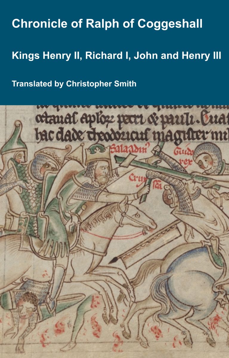
Chronicle of Abbot Ralph of Coggeshall
The Chronicle of Abbot Ralph of Coggeshall (Chronicon Anglicanum) is an indispensable medieval history that brings to life centuries of English and European affairs through the eyes of a learned Cistercian monk. Ralph of Coggeshall, abbot of the Abbey of Coggeshall in Essex in the early 13th century, continued and expanded his community’s chronicle, documenting events from the Norman Conquest of 1066 into the tumultuous reign of King Henry III. Blending eyewitness testimony, careful compilation, and the monastic commitment to record-keeping, this chronicle offers a rare narrative of political intrigue, royal power struggles, and social upheaval in England and beyond. Ralph’s work captures the reigns of pivotal figures such as Richard I and King John, providing invaluable insights into their characters, decisions, and the forces that shaped medieval rule. More than a simple annal, Chronicon Anglicanum conveys the texture of medieval life and governance, making it a rich source for scholars and readers fascinated by English history, monastic authorship, and the shaping of the medieval world.
Available at Amazon in eBook and Paperback format.
Archaeologia Aeliana Series 4 Volume 30. Henry VI and his forces must have arrived in Tynedale at the end of April. Henry stayed at Bywell [Map]. The story of the Yorkists finding his helmet, cum corona et gladio i.e. along with his crown, sword, when they took the castle is not a later fiction, like the tales which connect Margaret with the district, but is mentioned in a contemporary record.19
Note 19. A Brief Latin Chronicle.
The River West Allen rises near Coldcleugh, Northumberland [Map] from where it flows past Carrshield, Northumberland [Map], Ninebanks, Northumberland [Map], Bearsbridge, Northumberland [Map] to just before Cupola Bridge, Northumberland [Map] where it converges with the River East Allen to form the River Allen.
The River East Allen rises near Allenheads, Northumberland [Map] from where it flows past Ropehaugh, Northumberland [Map], Spartylea, Northumberland [Map], Sinderhope, Northumberland [Map], Allendale Town, Northumberland [Map], Catton, Northumberland [Map] to just before Cupola Bridge, Northumberland [Map] where it converges with the River West Allen to form the River Allen.
The River North Tyne flows from Kielder Water, Northumberland [Map] past Greystead, Northumberland [Map], Bellingham [Map] to Redesmouth, Northumberland [Map] where it is joined by the River Rede.
It continues past Wark, Northumberland [Map], Nunwick, Northumberland [Map], Barrasford, Northumberland [Map], Chollerton, Northumberland [Map], Wall, Northumberland [Map] to Warden, Northumberland [Map] where it joins the River South Tyne to become the River Tyne.
The River Irthing rises from a number of becks and burns on Padderburn Moor, Northumberland [Map] from where it flows past Churnsike Lodge, Northumberland [Map], Butterburn, Westmoreland and Lampert, Northumberland [Map] where it is joined by the Butter Burn, Smith Farm, Northumberland [Map], Gilsland Spa, Northumberland [Map], Gilsland, Northumberland [Map], Nether Denton, Cumberland [Map], under Lanercost Old Bridge, Cumberland [Map], past Irthington, Cumberland [Map] to Newby East, Cumberland [Map] after which it joins the River Eden.
The River West Allen rises near Coldcleugh, Northumberland [Map] from where it flows past Carrshield, Northumberland [Map], Ninebanks, Northumberland [Map], Bearsbridge, Northumberland [Map] to just before Cupola Bridge, Northumberland [Map] where it converges with the River East Allen to form the River Allen.
The River Tyne is formed from the River North Tyne and River South Tyne which converge at Warden, Northumberland [Map]. From Warden, Northumberland [Map] it flows past Hexham, Northumberland [Map], Corbridge, Northumberland [Map], Riding Mill, Northumberland [Map], Bywell, Northumberland [Map], Ovingham, Northumberland [Map], Clara Vale, Northumberland [Map], Blaydon, Northumberland [Map], Newcastle upon Tyne, Northumberland [Map] and Wallsend [Map] and North Shields, Northumberland [Map] and South Shields, County Durham [Map] after which it joins the North Sea at Tynemouth, Northumberland [Map].
From Corbridge Roman Fort, Northumberland [Map] Dere Street continues north through Hunnum aka Onnum Roman Fort [Map], where it crosses Hadrian's Wall, Little Whittington, Northumberland [Map], Beukley, Northumberland [Map], Great Swinburne, Northumberland [Map], Fourlaws Roman Camp [Map], Habitancum Roman Fort [Map], Blakehope Roman Fort [Map], High Rochester, Northumberland [Map], Featherwood Roman Camps [Map], Chew Green Roman Camps [Map] where it crosses the River Coquet and into Scotland.
Stanegate Roman Road is a Roman Road that ran from Corbridge Roman Fort, Northumberland [Map], where Dere Street crossed the River Tyne, to Luguvalium Roman Town [Map] aka Carlisle. It predated Hadrians Wall, subsequently built north of it, by several decades.
East to west Stanegate Roman Road started at Corbridge Roman Fort, Northumberland [Map], then passed through Wall, Northumberland [Map], Fourstones, Northumberland [Map], Newbrough, Northumberland [Map], Vindolandia, Northumberland [Map], Haltwhistle Roman Fort [Map], Magnis aka Carvoran Roman Fort [Map], Nether Denton Roman Fort [Map], Brampton Roman Fort [Map] to Carlisle [Map] where the Roman Fort was located where Carlisle Castle is now. The road may possibly have continued to Kirkbride, Cumberland [Map].
Chronicle of Abbot Ralph of Coggeshall
The Chronicle of Abbot Ralph of Coggeshall (Chronicon Anglicanum) is an indispensable medieval history that brings to life centuries of English and European affairs through the eyes of a learned Cistercian monk. Ralph of Coggeshall, abbot of the Abbey of Coggeshall in Essex in the early 13th century, continued and expanded his community’s chronicle, documenting events from the Norman Conquest of 1066 into the tumultuous reign of King Henry III. Blending eyewitness testimony, careful compilation, and the monastic commitment to record-keeping, this chronicle offers a rare narrative of political intrigue, royal power struggles, and social upheaval in England and beyond. Ralph’s work captures the reigns of pivotal figures such as Richard I and King John, providing invaluable insights into their characters, decisions, and the forces that shaped medieval rule. More than a simple annal, Chronicon Anglicanum conveys the texture of medieval life and governance, making it a rich source for scholars and readers fascinated by English history, monastic authorship, and the shaping of the medieval world.
Available at Amazon in eBook and Paperback format.
From Eboracum aka York [Map] Dere Street travels to Aldborough [Map], Leeming Bar, North Yorkshire [Map], Cataractonium [Map] aka Catterick, Piercebridge, County Durham [Map], Vinovia aka Binchester, County Durham [Map], on the banks of the River Wear, Ebchester, County Durham [Map], where it crosses the County Durham River Derwent, Corbridge Roman Fort, Northumberland [Map], where it, and crosses the River Tyne and Stanegate Roman Road began.
Cupola Bridge, Northumberland [Map] is a stone bridge over the River Allen with three segmental arches, the central taller, with arch rings and double keystones, round-ended cutwaters topped by band.
The River West Allen rises near Coldcleugh, Northumberland [Map] from where it flows past Carrshield, Northumberland [Map], Ninebanks, Northumberland [Map], Bearsbridge, Northumberland [Map] to just before Cupola Bridge, Northumberland [Map] where it converges with the River East Allen to form the River Allen.
The River East Allen rises near Allenheads, Northumberland [Map] from where it flows past Ropehaugh, Northumberland [Map], Spartylea, Northumberland [Map], Sinderhope, Northumberland [Map], Allendale Town, Northumberland [Map], Catton, Northumberland [Map] to just before Cupola Bridge, Northumberland [Map] where it converges with the River West Allen to form the River Allen.
1775. Featherstone Bridge, Northumberland [Map] is stone arch bridge completed in 1775.
The River South Tyne rises on Cross Fell, Westmoreland [Map] from where it flows past Garrigill Westmoreland [Map], Alston [Map] where it is joined by the River Nent.
Thereafter it flows past Kirkhaugh, Northumberland [Map], Knarsdale, Northumberland [Map], Lambley, Northumberland [Map], Featherstone Castle, Northumberland [Map], under Featherstone Bridge, Northumberland [Map], Haltwhistle, Northumberland [Map], Melkridge, Northumberland [Map], Ridley, Northumberland [Map] after which it is joined by the River Allen
Featherstone Castle, Northumberland is also in Castles in Northumberland.
The River South Tyne rises on Cross Fell, Westmoreland [Map] from where it flows past Garrigill Westmoreland [Map], Alston [Map] where it is joined by the River Nent.
Thereafter it flows past Kirkhaugh, Northumberland [Map], Knarsdale, Northumberland [Map], Lambley, Northumberland [Map], Featherstone Castle, Northumberland [Map], under Featherstone Bridge, Northumberland [Map], Haltwhistle, Northumberland [Map], Melkridge, Northumberland [Map], Ridley, Northumberland [Map] after which it is joined by the River Allen
East to west Stanegate Roman Road started at Corbridge Roman Fort, Northumberland [Map], then passed through Wall, Northumberland [Map], Fourstones, Northumberland [Map], Newbrough, Northumberland [Map], Vindolandia, Northumberland [Map], Haltwhistle Roman Fort [Map], Magnis aka Carvoran Roman Fort [Map], Nether Denton Roman Fort [Map], Brampton Roman Fort [Map] to Carlisle [Map] where the Roman Fort was located where Carlisle Castle is now. The road may possibly have continued to Kirkbride, Cumberland [Map].
The River Irthing rises from a number of becks and burns on Padderburn Moor, Northumberland [Map] from where it flows past Churnsike Lodge, Northumberland [Map], Butterburn, Westmoreland and Lampert, Northumberland [Map] where it is joined by the Butter Burn, Smith Farm, Northumberland [Map], Gilsland Spa, Northumberland [Map], Gilsland, Northumberland [Map], Nether Denton, Cumberland [Map], under Lanercost Old Bridge, Cumberland [Map], past Irthington, Cumberland [Map] to Newby East, Cumberland [Map] after which it joins the River Eden.
From Corbridge Roman Fort, Northumberland [Map] Dere Street continues north through Hunnum aka Onnum Roman Fort [Map], where it crosses Hadrian's Wall, Little Whittington, Northumberland [Map], Beukley, Northumberland [Map], Great Swinburne, Northumberland [Map], Fourlaws Roman Camp [Map], Habitancum Roman Fort [Map], Blakehope Roman Fort [Map], High Rochester, Northumberland [Map], Featherwood Roman Camps [Map], Chew Green Roman Camps [Map] where it crosses the River Coquet and into Scotland.
Henrici Quinti, Angliæ Regis, Gesta, is a first-hand account of the Agincourt Campaign, and subsequent events to his death in 1422. The author of the first part was a Chaplain in King Henry's retinue who was present from King Henry's departure at Southampton in 1415, at the siege of Harfleur, the battle of Agincourt, and the celebrations on King Henry's return to London. The second part, by another writer, relates the events that took place including the negotiations at Troye, Henry's marriage and his death in 1422.
Available at Amazon in eBook and Paperback format.
The Devil's Causeway is a Roman Road from the Portgate, Northumberland [Map], where it crossed Dere Street, to Berwick-upon-Tweed, Northumberland [Map]. It passes through Great Whittingham, Northumberland [Map], Hartburn, Northumberland [Map], where it crosses the Hart Burn, Netherwitton, Northumberland [Map], Longhorsley, Northumberland [Map], Brinkburn Priory, Northumberland [Map], whereit crosses the River Coquet, north of North End [Map], Edlingham, Northumberland [Map] to Learchild Roman Fort [Map] where another road headed west to meet Dere Street at Bremenium [Map] aka High Rochester. The road then continues north passing Glanton, Northumberland [Map], Powburn, Northumberland [Map], where it crosses the River Till aka Breamish, the site of the Battle of Hedgeley Moor [Map], Newtown, Northumberland [Map], East Horton, Northumberland [Map], Lowick, Northumberland [Map], Berrington, Northumberland [Map] before reaching Berwick-upon-Tweed, Northumberland [Map].
The River North Tyne flows from Kielder Water, Northumberland [Map] past Greystead, Northumberland [Map], Bellingham [Map] to Redesmouth, Northumberland [Map] where it is joined by the River Rede.
It continues past Wark, Northumberland [Map], Nunwick, Northumberland [Map], Barrasford, Northumberland [Map], Chollerton, Northumberland [Map], Wall, Northumberland [Map] to Warden, Northumberland [Map] where it joins the River South Tyne to become the River Tyne.
From Corbridge Roman Fort, Northumberland [Map] Dere Street continues north through Hunnum aka Onnum Roman Fort [Map], where it crosses Hadrian's Wall, Little Whittington, Northumberland [Map], Beukley, Northumberland [Map], Great Swinburne, Northumberland [Map], Fourlaws Roman Camp [Map], Habitancum Roman Fort [Map], Blakehope Roman Fort [Map], High Rochester, Northumberland [Map], Featherwood Roman Camps [Map], Chew Green Roman Camps [Map] where it crosses the River Coquet and into Scotland.
The River South Tyne rises on Cross Fell, Westmoreland [Map] from where it flows past Garrigill Westmoreland [Map], Alston [Map] where it is joined by the River Nent.
Thereafter it flows past Kirkhaugh, Northumberland [Map], Knarsdale, Northumberland [Map], Lambley, Northumberland [Map], Featherstone Castle, Northumberland [Map], under Featherstone Bridge, Northumberland [Map], Haltwhistle, Northumberland [Map], Melkridge, Northumberland [Map], Ridley, Northumberland [Map] after which it is joined by the River Allen
East to west Stanegate Roman Road started at Corbridge Roman Fort, Northumberland [Map], then passed through Wall, Northumberland [Map], Fourstones, Northumberland [Map], Newbrough, Northumberland [Map], Vindolandia, Northumberland [Map], Haltwhistle Roman Fort [Map], Magnis aka Carvoran Roman Fort [Map], Nether Denton Roman Fort [Map], Brampton Roman Fort [Map] to Carlisle [Map] where the Roman Fort was located where Carlisle Castle is now. The road may possibly have continued to Kirkbride, Cumberland [Map].
Harbottle Castle, Northumberland is also in Castles in Northumberland.
Between 1157 and 1174 Odinel Umfraville [aged 32] commissioned the building of Harbottle Castle, Northumberland [Map]. In 1174 it was captured by the Scots who lost it a year later after which it was rebuilt and improved.
In 1310 Robert the Bruce [aged 35] captured Harbottle Castle, Northumberland [Map].
In 1509 George Tailboys 9th Baron Kyme [aged 42] was Keeper of at Harbottle Castle, Northumberland [Map].

In 1515 Harbottle Castle, Northumberland [Map] became the residence of Archibald Douglas 6th Earl Angus [aged 26] and Margaret Tudor Queen Scotland [aged 25] after they had been banished by John Stewart 2nd Duke Albany [aged 31].
On 8th October 1515 Margaret Douglas Countess Lennox was born to Archibald Douglas 6th Earl Angus [aged 26] and Margaret Tudor Queen Scotland [aged 25] at Harbottle Castle, Northumberland [Map]. She a granddaughter of King Henry VII of England and Ireland. She married (1) 1535 her fifth cousin once removed Thomas Howard, son of Thomas Howard 2nd Duke of Norfolk and Agnes Tilney Duchess Norfolk (2) 6th July 1544 her third cousin once removed Matthew Stewart 4th Earl Lennox, son of John Stewart 3rd Earl Lennox and Isabel or Elizabeth Stewart Countess Lennox, and had issue.
Jean de Waurin's Chronicle of England Volume 6 Books 3-6: The Wars of the Roses
Jean de Waurin was a French Chronicler, from the Artois region, who was born around 1400, and died around 1474. Waurin’s Chronicle of England, Volume 6, covering the period 1450 to 1471, from which we have selected and translated Chapters relating to the Wars of the Roses, provides a vivid, original, contemporary description of key events some of which he witnessed first-hand, some of which he was told by the key people involved with whom Waurin had a personal relationship.
Available at Amazon in eBook and Paperback format.
In 1605 King James I of England and Ireland and VI of Scotland [aged 38] granted Harbottle Castle, Northumberland [Map] to George Home 1st Earl Dunbar [aged 49].


2022. Photos of Harbottle Castle, Northumberland [Map].


The River Coquet rises around Chew Green, Northumberland [Map] from where it flows past Makendon Northumberland [Map], Blindburn, Northumberland [Map], Barrow Burn, Northumberland [Map], Shillmoor, Northumberland [Map], Linshiels, Northumberland [Map], Alwinton, Northumberland [Map], Harbottle Castle, Northumberland [Map], Sharperton, Northumberland [Map], Holystone, Northumberland [Map], Hepple, Northumberland [Map], Thropton, Northumberland [Map], Rothbury, Northumberland [Map], Pauperhaugh, Northumberland [Map], Brinkburn Priory, Northumberland [Map], Weldon Bridge, Northumberland [Map], Felton, Northumberland [Map], Guyzance, Northumberland [Map] before passing under the bridge at Warkworth Bridge, Northumberland [Map] and reaching the North Sea at Amble, Northumberland [Map].
Bede. 634. AD. The place is called in the English tongue Hefenfelth [Map], or the Heavenly Field [Map]290, which name it undoubtedly received of old as a presage of what was afterwards to happen, denoting, that the heavenly trophy was to be erected, the heavenly victory begun, and heavenly miracles shown forth to this day. The place is near the wall in the north which the Romans formerly drew across the whole of Britain from sea to sea, to restrain the onslaught of the barbarous nations, as has been said before. Hither also the brothers of the church of Hagustald291, which is not far distant, long ago made it their custom to resort every year, on the day before that on which King Oswald [aged 30] was afterwards slain, to keep vigils there for the health of his soul, and having sung many psalms of praise, to offer for him in the morning the sacrifice of the Holy Oblation. And since that good custom has spread, they have lately built a church there, which has attached additional sanctity and honour in the eyes of all men to that place [Map]292; and this with good reason; for it appears that there was no symbol of the Christian faith, no church, no altar erected throughout all the nation of the Bernicians, before that new leader in war, prompted by the zeal of his faith, set up this standard of the Cross as he was going to give battle to his barbarous enemy.
Note 290. For another instance of a name with an inner meaning, cf. II, 15. The site of the battle is probably seven or eight miles north of Hexham (v. next note), Oswald having taken up his position on the northern side of the Roman wall between the Tyne and the Solway (i.e., the wall attributed to Hadrian, cf. I, 12, p. 25, note). According to tradition the battle was finally won at a place called Halydene (Hallington?), two miles to the east.
Note 291. Hexham [Map]. Wilfrid built a magnificent church there between the years 672-678 on land given by Ethelthryth, wife of Egfrid, king of Northumbria. It became the see of a bishop in 678 when the great northern diocese was subdivided by Theodore (v. IV, 12). Bede's own monastery of Wearmouth and Jarrow was in the diocese of Hexham. The bishopric became extinct in 821.
Note 292. The place is still called St. Oswald's [Map], and a little chapel probably marks the spot.
![]() Become a Member via our Buy Me a Coffee page to read more.
Become a Member via our Buy Me a Coffee page to read more.
In 634 King Oswald of Northumberland [aged 30] won a decisive victory over the army of the Cadwallon ap Cadfan King Gwynedd at the Battle of Heavenfield which was fought at Heavenfield, Northumberland [Map] around six miles north of Hexham, Northumberland [Map].
Cadwallon ap Cadfan King Gwynedd was killed at a place Bede describes as Denisesburna which is possibly Rowley Water some eight miles south of the site of the battle.
The River North Tyne flows from Kielder Water, Northumberland [Map] past Greystead, Northumberland [Map], Bellingham [Map] to Redesmouth, Northumberland [Map] where it is joined by the River Rede.
It continues past Wark, Northumberland [Map], Nunwick, Northumberland [Map], Barrasford, Northumberland [Map], Chollerton, Northumberland [Map], Wall, Northumberland [Map] to Warden, Northumberland [Map] where it joins the River South Tyne to become the River Tyne.
The River South Tyne rises on Cross Fell, Westmoreland [Map] from where it flows past Garrigill Westmoreland [Map], Alston [Map] where it is joined by the River Nent.
Thereafter it flows past Kirkhaugh, Northumberland [Map], Knarsdale, Northumberland [Map], Lambley, Northumberland [Map], Featherstone Castle, Northumberland [Map], under Featherstone Bridge, Northumberland [Map], Haltwhistle, Northumberland [Map], Melkridge, Northumberland [Map], Ridley, Northumberland [Map] after which it is joined by the River Allen
The River Blyth rises near Kirkheaton, Northumberland [Map] from where it flows past Bradford [Map], Belsay, Northumberland [Map], Ogle, Northumberland [Map], Kirkley, Northumberland [Map], Horton Grange, Northumberland [Map], Stannington, Northumberland [Map], Bedlington, Northumberland [Map] to Blyth, Northumberland [Map] where it reaches the North Sea.
The River Blyth rises near Kirkheaton, Northumberland [Map] from where it flows past Bradford [Map], Belsay, Northumberland [Map], Ogle, Northumberland [Map], Kirkley, Northumberland [Map], Horton Grange, Northumberland [Map], Stannington, Northumberland [Map], Bedlington, Northumberland [Map] to Blyth, Northumberland [Map] where it reaches the North Sea.
Kirkley Castle, Northumberland is also in Castles in Northumberland.
Chronicle of Abbot Ralph of Coggeshall
The Chronicle of Abbot Ralph of Coggeshall (Chronicon Anglicanum) is an indispensable medieval history that brings to life centuries of English and European affairs through the eyes of a learned Cistercian monk. Ralph of Coggeshall, abbot of the Abbey of Coggeshall in Essex in the early 13th century, continued and expanded his community’s chronicle, documenting events from the Norman Conquest of 1066 into the tumultuous reign of King Henry III. Blending eyewitness testimony, careful compilation, and the monastic commitment to record-keeping, this chronicle offers a rare narrative of political intrigue, royal power struggles, and social upheaval in England and beyond. Ralph’s work captures the reigns of pivotal figures such as Richard I and King John, providing invaluable insights into their characters, decisions, and the forces that shaped medieval rule. More than a simple annal, Chronicon Anglicanum conveys the texture of medieval life and governance, making it a rich source for scholars and readers fascinated by English history, monastic authorship, and the shaping of the medieval world.
Available at Amazon in eBook and Paperback format.
Around 1410 Joan Ogle was born to Robert Ogle [aged 40] and Matilda Grey [aged 28] at Kirkley Castle, Northumberland [Map]. She a great x 4 granddaughter of King Edward I of England. She married in or before 1447 Robert Manners and had issue.
The River Wansbeck rises near Risdale, Northumberland [Map] from where it flows past Kirkwhelpington, Northumberland [Map], Wallington, Northumberland [Map], Low Angerton, Northumberland [Map] to Meldon Park, Northumberland [Map] where it is joined by the Hart Burn.
The River Wansbeck continues through Mitford, Northumberland [Map] where it is joined by the River Font.
After Mitford, Northumberland [Map] the River Wansbeck flows past Morpeth, Northumberland [Map], Guidepost, Northumberland [Map] and Stakeford, Northumberland [Map] before joining the North Sea at Cambois, Northumberland [Map].
Until 1552 Little Harle Tower, Kirkwhelpington [Map] was the property of the Fenwick family, from whom it passed to the Aynsleys.
On 9th June 1792 Gawen Aynsley died. His great-niece and heiress Alicia Miford aka Mitford-Aynsley [aged 24] changed her surname from Mitford to Mitford-Aynsley; she inherited Little Harle Tower, Kirkwhelpington [Map].
Before 5th May 1808 Charles Murray aka Aynesley-Murray [aged 36] and Alicia Miford aka Mitford-Aynsley [aged 39] lived at Little Harle Tower, Kirkwhelpington [Map].
Around 1848 Little Harle Tower, Kirkwhelpington [Map] was purchased by Thomas Anderson.

After 14th July 1915. St Wilfrid's Church, Kirkharle [Map]. Memorial to John Frederick Anderson. Buried at Le Touret Military Cemetery, Richebourg-L'avoue, France. Killed whilst serving with the 2nd Battalion attached (Adjutant) 10th Battalion Highland Light Infantry. He was the son of George and Alice Anderson of Little Harle Tower, Kirkwhelpington [Map].
The River South Tyne rises on Cross Fell, Westmoreland [Map] from where it flows past Garrigill Westmoreland [Map], Alston [Map] where it is joined by the River Nent.
Thereafter it flows past Kirkhaugh, Northumberland [Map], Knarsdale, Northumberland [Map], Lambley, Northumberland [Map], Featherstone Castle, Northumberland [Map], under Featherstone Bridge, Northumberland [Map], Haltwhistle, Northumberland [Map], Melkridge, Northumberland [Map], Ridley, Northumberland [Map] after which it is joined by the River Allen
Chronicle of Walter of Guisborough. In the same month of April, the above-mentioned Scottish earls, with a large army of Scots, having come from the castle of Jedburgh, entered our lands in the valley of the Rede on the sixth day before the Ides of April [8th April 1296], and laid siege to the castle of Harbottle for two days. But when they saw that they were making no progress, in fact, having lost some of their men, they left there, devastating and burning the lands on the eastern side of the Tyne, Coquetdale, Redesdale, and Northumberland, including Corbridge, as far as Hexham. There, with the canons having fled, they took lodging and forcibly intruded, on the feast day of Saint Leo the Pope [11th April 1296], which fell on a Wednesday. The next morning, having already plundered the monastery of almost all its goods, they set it on fire, not only the church, but also the entire monastery and village, in a deed almost unheard of. For they had forgotten, or rather, held in contempt, the memory of the revered patron of that house and of all Scotland, namely the most blessed apostle Andrew, whom they had long claimed as the patron saint of their kingdom. From there, they turned and burned with dreadful fire the house of the holy nuns of Lambley [Map], along with other nearby properties in the region. At the end of that Thursday they lodged at Lanercost [Map]. But though it had been their intention to continue farther, God did not will it, and so they were hindered. For a messenger from their own side arrived, announcing that the army of the king of England was coming soon or was already at the gates. Terrified and stunned at this, and having already burned some of the buildings of that monastery, but not the church, they turned back very early on Friday morning through the middle of Nicholas Forest with a great amount of plunder.
Eodem mense Aprili prædicti comites Scotia superius nominati, cum Scotorum exercitu copioso, a castro de Gedeworth venientes, sexto idus Aprilis ingressi sunt fines nostros in Valle de Reede, obsidentes castellum de Hyrbotil per duos dies; sed cum proficere se non viderent, immo perdidissent ex suis aliquos, digressi sunt inde, vastantes et concremantes ex orientali parte de Tyne, Cokedale, Redesdale et Northumbriam, cum Corebrigge, usque Hexceldesham, ibidemque, fugientibus canonicis, hospitati sunt et intrusi, die scilicet sancti Leonis papæ, quæ fuit feria quarta. Mane autem facto, cum jam monasterium illud omnibus quasi bonis spoliassent, apposuerunt et ignem, et non tantum ecclesiam immo et monasterium cum villa tota inaudito facinore combusserunt. Obliti namque sunt, immo potius contempserunt, memoriam reverendi patroni ejusdem domus et quondam totius Scotiæ, beatissimi scilicet Andreæ apostoli, parvipendentes illum quem patronum regni Scotia antiquitus nominare solebant. Inde vero divertentes, domum sanctarum monialium de Lameslay, cum cæteris adjacentibus in patria, incendio horribili concremarunt, in fine illius diei Jovis pernoctantes apud Lanercost. Cumque eorum fuisset voluntatis ulterius procedere, noluit ipse Deus, et ideo impediti sunt: affuit enim nuncius ex suis qui diceret quod exercitus regis Angliæ veniens in proximo vel in januis assisteret. Attoniti vero et stupefacti in hoc, cum quasdam domus ejusdem monasterii, non tamen ecclesiam, incendissent, summo mane diei Veneris per medium forestæ Nicholay cum magna præda reversi sunt.
![]() Become a Member via our Buy Me a Coffee page to read more.
Become a Member via our Buy Me a Coffee page to read more.
The History of William Marshal was commissioned by his son shortly after William’s death in 1219 to celebrate the Marshal’s remarkable life; it is an authentic, contemporary voice. The manuscript was discovered in 1861 by French historian Paul Meyer. Meyer published the manuscript in its original Anglo-French in 1891 in two books. This book is a line by line translation of the first of Meyer’s books; lines 1-10152. Book 1 of the History begins in 1139 and ends in 1194. It describes the events of the Anarchy, the role of William’s father John, John’s marriages, William’s childhood, his role as a hostage at the siege of Newbury, his injury and imprisonment in Poitou where he met Eleanor of Aquitaine and his life as a knight errant. It continues with the accusation against him of an improper relationship with Margaret, wife of Henry the Young King, his exile, and return, the death of Henry the Young King, the rebellion of Richard, the future King Richard I, war with France, the death of King Henry II, and the capture of King Richard, and the rebellion of John, the future King John. It ends with the release of King Richard and the death of John Marshal.
Available at Amazon in eBook and Paperback format.
The River South Tyne rises on Cross Fell, Westmoreland [Map] from where it flows past Garrigill Westmoreland [Map], Alston [Map] where it is joined by the River Nent.
Thereafter it flows past Kirkhaugh, Northumberland [Map], Knarsdale, Northumberland [Map], Lambley, Northumberland [Map], Featherstone Castle, Northumberland [Map], under Featherstone Bridge, Northumberland [Map], Haltwhistle, Northumberland [Map], Melkridge, Northumberland [Map], Ridley, Northumberland [Map] after which it is joined by the River Allen
The River Irthing rises from a number of becks and burns on Padderburn Moor, Northumberland [Map] from where it flows past Churnsike Lodge, Northumberland [Map], Butterburn, Westmoreland and Lampert, Northumberland [Map] where it is joined by the Butter Burn, Smith Farm, Northumberland [Map], Gilsland Spa, Northumberland [Map], Gilsland, Northumberland [Map], Nether Denton, Cumberland [Map], under Lanercost Old Bridge, Cumberland [Map], past Irthington, Cumberland [Map] to Newby East, Cumberland [Map] after which it joins the River Eden.
The River Aln rises near Alnham, Northumberland [Map] from where it flows past Whittingham, Northumberland [Map], Bolton, Northumberland [Map], Hulne Priory, Northumberland [Map] then passing around Alnwick Castle, Northumberland [Map] before passing Lesbury, Northumberland [Map] then at Alnwick, Northumberland [Map] it joins the North Sea.
The River Coquet rises around Chew Green, Northumberland [Map] from where it flows past Makendon Northumberland [Map], Blindburn, Northumberland [Map], Barrow Burn, Northumberland [Map], Shillmoor, Northumberland [Map], Linshiels, Northumberland [Map], Alwinton, Northumberland [Map], Harbottle Castle, Northumberland [Map], Sharperton, Northumberland [Map], Holystone, Northumberland [Map], Hepple, Northumberland [Map], Thropton, Northumberland [Map], Rothbury, Northumberland [Map], Pauperhaugh, Northumberland [Map], Brinkburn Priory, Northumberland [Map], Weldon Bridge, Northumberland [Map], Felton, Northumberland [Map], Guyzance, Northumberland [Map] before passing under the bridge at Warkworth Bridge, Northumberland [Map] and reaching the North Sea at Amble, Northumberland [Map].
From Corbridge Roman Fort, Northumberland [Map] Dere Street continues north through Hunnum aka Onnum Roman Fort [Map], where it crosses Hadrian's Wall, Little Whittington, Northumberland [Map], Beukley, Northumberland [Map], Great Swinburne, Northumberland [Map], Fourlaws Roman Camp [Map], Habitancum Roman Fort [Map], Blakehope Roman Fort [Map], High Rochester, Northumberland [Map], Featherwood Roman Camps [Map], Chew Green Roman Camps [Map] where it crosses the River Coquet and into Scotland.
The Devil's Causeway is a Roman Road from the Portgate, Northumberland [Map], where it crossed Dere Street, to Berwick-upon-Tweed, Northumberland [Map]. It passes through Great Whittingham, Northumberland [Map], Hartburn, Northumberland [Map], where it crosses the Hart Burn, Netherwitton, Northumberland [Map], Longhorsley, Northumberland [Map], Brinkburn Priory, Northumberland [Map], whereit crosses the River Coquet, north of North End [Map], Edlingham, Northumberland [Map] to Learchild Roman Fort [Map] where another road headed west to meet Dere Street at Bremenium [Map] aka High Rochester. The road then continues north passing Glanton, Northumberland [Map], Powburn, Northumberland [Map], where it crosses the River Till aka Breamish, the site of the Battle of Hedgeley Moor [Map], Newtown, Northumberland [Map], East Horton, Northumberland [Map], Lowick, Northumberland [Map], Berrington, Northumberland [Map] before reaching Berwick-upon-Tweed, Northumberland [Map].
The Devil's Causeway is a Roman Road from the Portgate, Northumberland [Map], where it crossed Dere Street, to Berwick-upon-Tweed, Northumberland [Map]. It passes through Great Whittingham, Northumberland [Map], Hartburn, Northumberland [Map], where it crosses the Hart Burn, Netherwitton, Northumberland [Map], Longhorsley, Northumberland [Map], Brinkburn Priory, Northumberland [Map], whereit crosses the River Coquet, north of North End [Map], Edlingham, Northumberland [Map] to Learchild Roman Fort [Map] where another road headed west to meet Dere Street at Bremenium [Map] aka High Rochester. The road then continues north passing Glanton, Northumberland [Map], Powburn, Northumberland [Map], where it crosses the River Till aka Breamish, the site of the Battle of Hedgeley Moor [Map], Newtown, Northumberland [Map], East Horton, Northumberland [Map], Lowick, Northumberland [Map], Berrington, Northumberland [Map] before reaching Berwick-upon-Tweed, Northumberland [Map].

Chronicle of a Bourgeois of Valenciennes
Récits d’un bourgeois de Valenciennes aka The Chronicle of a Bourgeois of Valenciennes is a vivid 14th-century vernacular chronicle written by an anonymous urban chronicler from Valenciennes in the County of Hainaut. It survives in a manuscript that describes local and regional history from about 1253 to 1366, blending chronology, narrative episodes, and eyewitness-style accounts of political, military, and social events in medieval France, Flanders, and the Low Countries. The work begins with a chronological framework of events affecting Valenciennes and its region under rulers such as King Philip VI of France and the shifting allegiances of local nobility. It includes accounts of conflicts, sieges, diplomatic manoeuvres, and the impact of broader struggles like the Hundred Years’ War on urban life in Hainaut. Written from the perspective of a burgher (bourgeois) rather than a monastery or royal court, the chronicle offers a rare lay viewpoint on high politics and warfare, reflecting how merchants, townspeople, and civic institutions experienced the turbulence of the 13th and 14th centuries. Its narrative style combines straightforward reporting of events with moral and civic observations, making it a valuable source for readers interested in medieval urban society, regional politics, and the lived experience of war and governance in pre-modern Europe.
Available at Amazon in eBook and Paperback format.
Around 1777 Lieutenant-General George Burrell was born at Longhoughton, Northumberland.
The River Wansbeck rises near Risdale, Northumberland [Map] from where it flows past Kirkwhelpington, Northumberland [Map], Wallington, Northumberland [Map], Low Angerton, Northumberland [Map] to Meldon Park, Northumberland [Map] where it is joined by the Hart Burn.
The River Wansbeck continues through Mitford, Northumberland [Map] where it is joined by the River Font.
After Mitford, Northumberland [Map] the River Wansbeck flows past Morpeth, Northumberland [Map], Guidepost, Northumberland [Map] and Stakeford, Northumberland [Map] before joining the North Sea at Cambois, Northumberland [Map].
The Devil's Causeway is a Roman Road from the Portgate, Northumberland [Map], where it crossed Dere Street, to Berwick-upon-Tweed, Northumberland [Map]. It passes through Great Whittingham, Northumberland [Map], Hartburn, Northumberland [Map], where it crosses the Hart Burn, Netherwitton, Northumberland [Map], Longhorsley, Northumberland [Map], Brinkburn Priory, Northumberland [Map], whereit crosses the River Coquet, north of North End [Map], Edlingham, Northumberland [Map] to Learchild Roman Fort [Map] where another road headed west to meet Dere Street at Bremenium [Map] aka High Rochester. The road then continues north passing Glanton, Northumberland [Map], Powburn, Northumberland [Map], where it crosses the River Till aka Breamish, the site of the Battle of Hedgeley Moor [Map], Newtown, Northumberland [Map], East Horton, Northumberland [Map], Lowick, Northumberland [Map], Berrington, Northumberland [Map] before reaching Berwick-upon-Tweed, Northumberland [Map].
The River Coquet rises around Chew Green, Northumberland [Map] from where it flows past Makendon Northumberland [Map], Blindburn, Northumberland [Map], Barrow Burn, Northumberland [Map], Shillmoor, Northumberland [Map], Linshiels, Northumberland [Map], Alwinton, Northumberland [Map], Harbottle Castle, Northumberland [Map], Sharperton, Northumberland [Map], Holystone, Northumberland [Map], Hepple, Northumberland [Map], Thropton, Northumberland [Map], Rothbury, Northumberland [Map], Pauperhaugh, Northumberland [Map], Brinkburn Priory, Northumberland [Map], Weldon Bridge, Northumberland [Map], Felton, Northumberland [Map], Guyzance, Northumberland [Map] before passing under the bridge at Warkworth Bridge, Northumberland [Map] and reaching the North Sea at Amble, Northumberland [Map].
The River Wansbeck rises near Risdale, Northumberland [Map] from where it flows past Kirkwhelpington, Northumberland [Map], Wallington, Northumberland [Map], Low Angerton, Northumberland [Map] to Meldon Park, Northumberland [Map] where it is joined by the Hart Burn.
The River Wansbeck continues through Mitford, Northumberland [Map] where it is joined by the River Font.
After Mitford, Northumberland [Map] the River Wansbeck flows past Morpeth, Northumberland [Map], Guidepost, Northumberland [Map] and Stakeford, Northumberland [Map] before joining the North Sea at Cambois, Northumberland [Map].
The Hart Burn rises near Harwood, Northumberland [Map] from where it flows past Hetherton House, Northumberland [Map], Scots Gap, Northumberland [Map], Hartburn, Northumberland [Map] to Meldon Park, Northumberland [Map] where it joins the River Wansbeck.
The River South Tyne rises on Cross Fell, Westmoreland [Map] from where it flows past Garrigill Westmoreland [Map], Alston [Map] where it is joined by the River Nent.
Thereafter it flows past Kirkhaugh, Northumberland [Map], Knarsdale, Northumberland [Map], Lambley, Northumberland [Map], Featherstone Castle, Northumberland [Map], under Featherstone Bridge, Northumberland [Map], Haltwhistle, Northumberland [Map], Melkridge, Northumberland [Map], Ridley, Northumberland [Map] after which it is joined by the River Allen

In 1673 Admiral Ralph Delaval [aged 32] sold Dissington Hall, Ponteland [Map] to Edward Collingwood of Byker and Dissington.
In 1794 Edward Collingwood [aged 60] commissioned architect William Newton to build Dissington Hall, Ponteland [Map] on the site. Construction was completed by 1797.
In 1806 Edward Collingwood [aged 72] died. His great-nephew Edward Spencer-Stanhope aka Collingwood [aged 14], grandson of his sister Winifred Collingwood, inherited Dissington Hall, Ponteland [Map] on condition he changed his surname to Collingwood.
Ponteland Castle is also in Castles in Northumberland.
Froissart Book 13. The next day the Scots dislodged and returned towards their own country, and so came to a castle and a town called Pontland [Map], whereof sir Edmund of Alphel was lord, who was a right good knight. There the Scots rested, for they came thither betimes, and understood that the knight was in his castle. Then they ordained to assail the castle, and gave a great assault, so that by force of arms they won it and the knight within it. Then the town and castle was brent; and from thence the Scots went to the town and castle of Otterburn [Map], an eight English mile from Newcastle1 and there lodged. That day they made none assault, but the next morning they blew their horns and made ready to assail the castle, which was strong, for it stood in the marish. That day they assaulted till they were weary, and did nothing. Then they sowned the retreat and returned to their lodgings. Then the lords drew to council to determine what they should do. The most part were of the accord that the next day they should dislodge without giving of any assault and to draw fair and easily towards Carlisle. But the earl Douglas brake that counsel and said: 'In despite of sir Henry Percy, who said he would come and win again his pennon, let us not depart hence for two or three days. Let us assail this castle: it is pregnable: we shall have double honour. And then let us see if he will come and fetch his pennon: he shall be well defended2.' Every man accorded to his saying, what for their honour and for the love of him. Also they lodged there at their ease, for there was none that troubled them: they made many lodgings of boughs and great herbs and fortified their camp sagely with the marish that was thereby, and their carriages were set at the entry into the marishes and had all their beasts within the marish. Then they apparelled for to assault the next day: this was their intention.
Note 1. Froissart says 'eight English leagues.' In the next chapter the distanch becomes 'seven little leagues,' and later on, 'a six English miles,' where the original is 'lieues.' The actual distance is about thirty miles. The translator gives the form 'Combur' here, but 'Ottenburge' in the next chapter, as the name of the place. It is remarkable indeed how little trouble he seems to have taken generally to give English names correctly. In this chapter we have 'Nymyche' for 'Alnwick' and 'Pouclan' for 'Pontland,' forms rather less like the real names than those which he found in the French text, viz. Nynich and Ponclau.
Note 2. Froissart says, 'if he comes, it shall be defended.' The translator perhaps means 'he shall be prevented.'
![]() Become a Member via our Buy Me a Coffee page to read more.
Become a Member via our Buy Me a Coffee page to read more.
St Mary's Church Ponteland is also in Churches in Northumberland.
St Mary's Church Ponteland [Map]. Many wall monuments, including:- Richard Newton Ogle, 1794 by Coade; John Dixon, 1716 - extremely rustic; Anne Byne,mother, and Anne Byne, daughter 1769 and no date,with interesting inscriptions. Memorial tablets were added, for example to William Weallens, one of Robert Stephenson's engineers, and to a member of the Ogle family who mapped the coast of the Americas.
Henrici Quinti, Angliæ Regis, Gesta, is a first-hand account of the Agincourt Campaign, and subsequent events to his death in 1422. The author of the first part was a Chaplain in King Henry's retinue who was present from King Henry's departure at Southampton in 1415, at the siege of Harfleur, the battle of Agincourt, and the celebrations on King Henry's return to London. The second part, by another writer, relates the events that took place including the negotiations at Troye, Henry's marriage and his death in 1422.
Available at Amazon in eBook and Paperback format.
The River North Tyne flows from Kielder Water, Northumberland [Map] past Greystead, Northumberland [Map], Bellingham [Map] to Redesmouth, Northumberland [Map] where it is joined by the River Rede.
It continues past Wark, Northumberland [Map], Nunwick, Northumberland [Map], Barrasford, Northumberland [Map], Chollerton, Northumberland [Map], Wall, Northumberland [Map] to Warden, Northumberland [Map] where it joins the River South Tyne to become the River Tyne.
The River Rede rises near the border of Scotland and England by the Carter Bar Boundary Marker [Map] from where it flows past Catcleugh, Northamptonshire [Map], Cottonshopeburnfoot, Northumberland [Map], Rochester, Northumberland [Map] near the Bremenium [Map] Roman Fort, past Horsley, Northumberland [Map], Elishaw, Northumberland [Map], past Percy's Cross at the Site of the Battle of Otterburn [Map], Otterburn, Northumberland [Map], East and West Woodburn [Map] to Redesmouth, Northumberland [Map] where it joins the River North Tyne.
The River Tyne is formed from the River North Tyne and River South Tyne which converge at Warden, Northumberland [Map]. From Warden, Northumberland [Map] it flows past Hexham, Northumberland [Map], Corbridge, Northumberland [Map], Riding Mill, Northumberland [Map], Bywell, Northumberland [Map], Ovingham, Northumberland [Map], Clara Vale, Northumberland [Map], Blaydon, Northumberland [Map], Newcastle upon Tyne, Northumberland [Map] and Wallsend [Map] and North Shields, Northumberland [Map] and South Shields, County Durham [Map] after which it joins the North Sea at Tynemouth, Northumberland [Map].
The River South Tyne rises on Cross Fell, Westmoreland [Map] from where it flows past Garrigill Westmoreland [Map], Alston [Map] where it is joined by the River Nent.
Thereafter it flows past Kirkhaugh, Northumberland [Map], Knarsdale, Northumberland [Map], Lambley, Northumberland [Map], Featherstone Castle, Northumberland [Map], under Featherstone Bridge, Northumberland [Map], Haltwhistle, Northumberland [Map], Melkridge, Northumberland [Map], Ridley, Northumberland [Map] after which it is joined by the River Allen
The River Wansbeck rises near Risdale, Northumberland [Map] from where it flows past Kirkwhelpington, Northumberland [Map], Wallington, Northumberland [Map], Low Angerton, Northumberland [Map] to Meldon Park, Northumberland [Map] where it is joined by the Hart Burn.
The River Wansbeck continues through Mitford, Northumberland [Map] where it is joined by the River Font.
After Mitford, Northumberland [Map] the River Wansbeck flows past Morpeth, Northumberland [Map], Guidepost, Northumberland [Map] and Stakeford, Northumberland [Map] before joining the North Sea at Cambois, Northumberland [Map].
From Corbridge Roman Fort, Northumberland [Map] Dere Street continues north through Hunnum aka Onnum Roman Fort [Map], where it crosses Hadrian's Wall, Little Whittington, Northumberland [Map], Beukley, Northumberland [Map], Great Swinburne, Northumberland [Map], Fourlaws Roman Camp [Map], Habitancum Roman Fort [Map], Blakehope Roman Fort [Map], High Rochester, Northumberland [Map], Featherwood Roman Camps [Map], Chew Green Roman Camps [Map] where it crosses the River Coquet and into Scotland.
The River Rede rises near the border of Scotland and England by the Carter Bar Boundary Marker [Map] from where it flows past Catcleugh, Northamptonshire [Map], Cottonshopeburnfoot, Northumberland [Map], Rochester, Northumberland [Map] near the Bremenium [Map] Roman Fort, past Horsley, Northumberland [Map], Elishaw, Northumberland [Map], past Percy's Cross at the Site of the Battle of Otterburn [Map], Otterburn, Northumberland [Map], East and West Woodburn [Map] to Redesmouth, Northumberland [Map] where it joins the River North Tyne.
Bremenium aka High Rochester, Northumberland [Map] is one of a number of defensive structures built along Dere Street. The name Bremenium means 'The Place of the Roaring Stream'. The site is in a strong position, occupying the end of a ridge with the ground falling away steeply to the north and west, and giving a clear view over the Rede Valley and beyond.
The fort is oblong in shape, and measures 148m north to south and 136m. Defensive ditches can still be seen to the north and east, outside which Dere Street passes. Early temporary marching camps at Redesdale are visible across the Sills Burn from the fort.
From Corbridge Roman Fort, Northumberland [Map] Dere Street continues north through Hunnum aka Onnum Roman Fort [Map], where it crosses Hadrian's Wall, Little Whittington, Northumberland [Map], Beukley, Northumberland [Map], Great Swinburne, Northumberland [Map], Fourlaws Roman Camp [Map], Habitancum Roman Fort [Map], Blakehope Roman Fort [Map], High Rochester, Northumberland [Map], Featherwood Roman Camps [Map], Chew Green Roman Camps [Map] where it crosses the River Coquet and into Scotland.
Henrici Quinti, Angliæ Regis, Gesta, is a first-hand account of the Agincourt Campaign, and subsequent events to his death in 1422. The author of the first part was a Chaplain in King Henry's retinue who was present from King Henry's departure at Southampton in 1415, at the siege of Harfleur, the battle of Agincourt, and the celebrations on King Henry's return to London. The second part, by another writer, relates the events that took place including the negotiations at Troye, Henry's marriage and his death in 1422.
Available at Amazon in eBook and Paperback format.
The Devil's Causeway is a Roman Road from the Portgate, Northumberland [Map], where it crossed Dere Street, to Berwick-upon-Tweed, Northumberland [Map]. It passes through Great Whittingham, Northumberland [Map], Hartburn, Northumberland [Map], where it crosses the Hart Burn, Netherwitton, Northumberland [Map], Longhorsley, Northumberland [Map], Brinkburn Priory, Northumberland [Map], whereit crosses the River Coquet, north of North End [Map], Edlingham, Northumberland [Map] to Learchild Roman Fort [Map] where another road headed west to meet Dere Street at Bremenium [Map] aka High Rochester. The road then continues north passing Glanton, Northumberland [Map], Powburn, Northumberland [Map], where it crosses the River Till aka Breamish, the site of the Battle of Hedgeley Moor [Map], Newtown, Northumberland [Map], East Horton, Northumberland [Map], Lowick, Northumberland [Map], Berrington, Northumberland [Map] before reaching Berwick-upon-Tweed, Northumberland [Map].
The River East Allen rises near Allenheads, Northumberland [Map] from where it flows past Ropehaugh, Northumberland [Map], Spartylea, Northumberland [Map], Sinderhope, Northumberland [Map], Allendale Town, Northumberland [Map], Catton, Northumberland [Map] to just before Cupola Bridge, Northumberland [Map] where it converges with the River West Allen to form the River Allen.
In 1720 Archdeacon Thomas Sharp [aged 26] was appointed Rector of Rothbury, Northumberland [Map].
The River Coquet rises around Chew Green, Northumberland [Map] from where it flows past Makendon Northumberland [Map], Blindburn, Northumberland [Map], Barrow Burn, Northumberland [Map], Shillmoor, Northumberland [Map], Linshiels, Northumberland [Map], Alwinton, Northumberland [Map], Harbottle Castle, Northumberland [Map], Sharperton, Northumberland [Map], Holystone, Northumberland [Map], Hepple, Northumberland [Map], Thropton, Northumberland [Map], Rothbury, Northumberland [Map], Pauperhaugh, Northumberland [Map], Brinkburn Priory, Northumberland [Map], Weldon Bridge, Northumberland [Map], Felton, Northumberland [Map], Guyzance, Northumberland [Map] before passing under the bridge at Warkworth Bridge, Northumberland [Map] and reaching the North Sea at Amble, Northumberland [Map].
The Hart Burn rises near Harwood, Northumberland [Map] from where it flows past Hetherton House, Northumberland [Map], Scots Gap, Northumberland [Map], Hartburn, Northumberland [Map] to Meldon Park, Northumberland [Map] where it joins the River Wansbeck.
East to west Stanegate Roman Road started at Corbridge Roman Fort, Northumberland [Map], then passed through Wall, Northumberland [Map], Fourstones, Northumberland [Map], Newbrough, Northumberland [Map], Vindolandia, Northumberland [Map], Haltwhistle Roman Fort [Map], Magnis aka Carvoran Roman Fort [Map], Nether Denton Roman Fort [Map], Brampton Roman Fort [Map] to Carlisle [Map] where the Roman Fort was located where Carlisle Castle is now. The road may possibly have continued to Kirkbride, Cumberland [Map].
East to west Stanegate Roman Road started at Corbridge Roman Fort, Northumberland [Map], then passed through Wall, Northumberland [Map], Fourstones, Northumberland [Map], Newbrough, Northumberland [Map], Vindolandia, Northumberland [Map], Haltwhistle Roman Fort [Map], Magnis aka Carvoran Roman Fort [Map], Nether Denton Roman Fort [Map], Brampton Roman Fort [Map] to Carlisle [Map] where the Roman Fort was located where Carlisle Castle is now. The road may possibly have continued to Kirkbride, Cumberland [Map].
The River North Tyne flows from Kielder Water, Northumberland [Map] past Greystead, Northumberland [Map], Bellingham [Map] to Redesmouth, Northumberland [Map] where it is joined by the River Rede.
It continues past Wark, Northumberland [Map], Nunwick, Northumberland [Map], Barrasford, Northumberland [Map], Chollerton, Northumberland [Map], Wall, Northumberland [Map] to Warden, Northumberland [Map] where it joins the River South Tyne to become the River Tyne.
