Henrici Quinti, Angliæ Regis, Gesta, is a first-hand account of the Agincourt Campaign, and subsequent events to his death in 1422. The author of the first part was a Chaplain in King Henry's retinue who was present from King Henry's departure at Southampton in 1415, at the siege of Harfleur, the battle of Agincourt, and the celebrations on King Henry's return to London. The second part, by another writer, relates the events that took place including the negotiations at Troye, Henry's marriage and his death in 1422.
Available at Amazon in eBook and Paperback format.
Irish Sea is in Rivers and River Systems in England and Wales.
The River Clwyd rises 8km north-west Corwen, Denbighshire [Map] from where it flows past Ruthin Castle [Map], Denbigh [Map], St Asaph [Map] to Rhuddlan Castle [Map], from where the remaining 4km were canalised when the castle wads constructed, entering the Irish Sea at Rhyl [Map].
The River Conwy rises on the on the Migneint moor where a number of small streams flow into Llyn Conwy [Map] from where it flows more or less north through Betws-y-Coed [Map], under Llanrwst Bridge, Clywd [Map] past Conwy Castle [Map] where it joins the Irish Sea.
The River Dovey rises nears Pennant, Gwynedd [Map] from where it flows past Dinas Mawddwy, Gwynedd [Map], Aberangell [Map], Cemmaes, Montgomeryshire [Map], Machynlleth [Map] to Aberdyfi [Map] where it joins the Irish Sea.
The River Eden rises near Aisgill, Westmoreland [Map] from where it flows past Mallerstang, Westmoreland [Map], Kirkby Stephen [Map], Little Musgrave, Westmoreland [Map], Warcop, Westmoreland [Map], Appleby-in-Westmoreland [Map], Bolton, Westmoreland [Map], Temple Sowerby, Westmoreland [Map], Long Meg and Her Daughters [Map], Armathwaite, Cumberland [Map], Wetheral, Cumberland [Map] to Carlisle, Cumberland [Map] after which it passes the Edward I Monument Burgh by Sands [Map] before joining the Irish Sea.
The River Irthing rises from a number of becks and burns on Padderburn Moor, Northumberland [Map] from where it flows past Churnsike Lodge, Northumberland [Map], Butterburn, Westmoreland and Lampert, Northumberland [Map] where it is joined by the Butter Burn, Smith Farm, Northumberland [Map], Gilsland Spa, Northumberland [Map], Gilsland, Northumberland [Map], Nether Denton, Cumberland [Map], under Lanercost Old Bridge, Cumberland [Map], past Irthington, Cumberland [Map] to Newby East, Cumberland [Map] after which it joins the River Eden.
The River Kent rises near Kentmere Reservoir, Cumberland [Map] from where it flows through Kentmere, Cumberland [Map], Staveley, Cumberland [Map], Kendal [Map], Sizergh, Cumberland [Map] to Sandside, Cumberland [Map] where it joins the Irish Sea.
The River Lune rises near Newbiggin-on-Lune, Westmoreland [Map] from where it flows past Kelleth, Westmoreland [Map], Tebay, Westmoreland [Map], Beckfoot, Westmoreland [Map], Firbank, Westmoreland [Map], Hallbeck, Westmoreland [Map], Middleton, Westmoreland [Map], Kirkby Lonsdale, Westmoreland [Map], Gressingham, Lancashire [Map] to Lancaster, Lancashire [Map] after which it joins the Irish Sea.
The River Ribble rises near Gearstones, North Yorkshire [Map], being formed from the Thorn Gill, from where it flows past Selside, North Yorkshire [Map] and Horton in Ribblesdale, North Yorkshire [Map], under Helwith Bridge, North Yorkshire [Map], over Stainforth Force [Map], through Settle, North Yorkshire [Map], past Paythorne, Lancashire [Map], Sawley, Lancashire [Map], Clitheroe, Lancashire [Map] to Great Mitton, Lancashire [Map] where it is joined by the River Hodder. It continues under Ribchester Bridge, Lancashire [Map] past Ribchester Roman Fort, Lancashire [Map] to Preston, Lancashire [Map] after which it joins the Irish Sea.
Bungerley Hippingstones [Map]. A ford, obtained by stepping-stones, across the River Ribble.
The River Hodder rises near the Cross of Greet, Lancashire [Map] from where it flows under the Cross of Greet Bridge [Map], through Stockes Reservoir [Map] to Slaidburn, Lancashire [Map]. From Slaidburn it flows past Newton-in-Bowland, Lancashire [Map], under Knowlmere Bridge, Lancashire [Map], past Dunsop Bridge, Lancashire [Map] where it is joined by the River Dunsop and shortly after by the Langden Brook, under Burnholme Bridge, Lancashire [Map], past Whitewell, Lancashire [Map], under Doeford Bridge, Lancashire [Map], High Hodder Brodge, Lancashire [Map] and Low Hodder Bridge, Lancashire [Map] after which it joins the River Ribble near Great Mitton, Lancashire [Map].
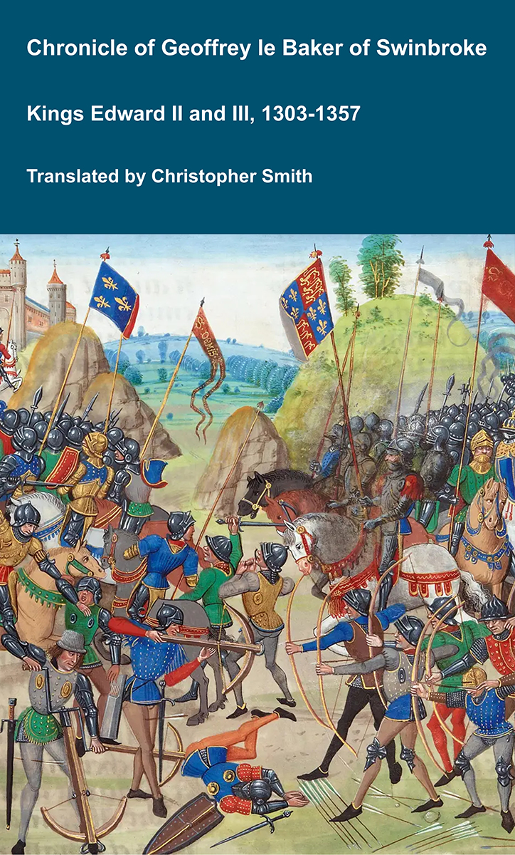
Chronicle of Geoffrey le Baker of Swinbroke
Baker was a secular clerk from Swinbroke, now Swinbrook, an Oxfordshire village two miles east of Burford. His Chronicle describes the events of the period 1303-1356: Gaveston, Bannockburn, Boroughbridge, the murder of King Edward II, the Scottish Wars, Sluys, Crécy, the Black Death, Winchelsea and Poitiers. To quote Herbert Bruce 'it possesses a vigorous and characteristic style, and its value for particular events between 1303 and 1356 has been recognised by its editor and by subsequent writers'. The book provides remarkable detail about the events it describes. Baker's text has been augmented with hundreds of notes, including extracts from other contemporary chronicles, such as the Annales Londonienses, Annales Paulini, Murimuth, Lanercost, Avesbury, Guisborough and Froissart to enrich the reader's understanding. The translation takes as its source the 'Chronicon Galfridi le Baker de Swynebroke' published in 1889, edited by Edward Maunde Thompson.
Available at Amazon in eBook and Paperback format.
The River Wyre rises near Tarnbrook, Lancashire [Map] from where it flows under Stoops Bridge, Abbeystead [Map], past Dolphinholme, Lancashire [Map], Garstang, Lancashire [Map], St Michael's on Wyre, Lancashire [Map] to Fleetwood, Lancashire [Map] where it joins the Irish Sea.